Home >> Projects >> U.S. 61 >> Modern Highway Photo Galleries
 Modern Highway Photos: La Crosse to Winona
October, 2007 (Page 1)
Page Index
- Page 1 - Southbound on I-90
- Page 2 - Southbound, La Crescent and the Jct. with State Hwy. 16
- Page 3 - Southbound, From La Crescent to the Wisconsin State Line
- Page 4 - Northbound, From the Wisconsin State Line to La Crescent
- Page 5 - Northbound, At the South Jct. with I-90 Near Dresbach
- Page 6 - Northbound, From Dakota to La Moille
- Page 7 - Northbound, From La Moille to Homer
- Page 8 - Northbound, From Homer to the Jct. with State Hwy. 43 at Winona
- Page 9 - At Winona, From the Jct. with State Hwy. 43 to Gilmore Avenue
- Page 10 - From the Jct. with U.S. 14 at Winona to County Road 32 at Goodview
The following long series of photos was taken on a cloudy day in the fall of 2007 while I was investigating old alignments of U.S. 61 between La Crosse and the Winona area in southeastern Minnesota. I started the day by driving into the area via I-90 from Rochester, meeting U.S. 61 at Dakota, and then traveling south to the Wisconsin State Line, where I turned around and headed back towards Winona.

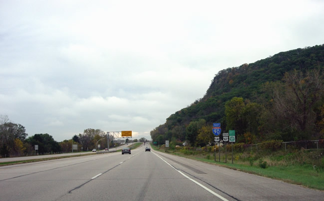
Southbound on the I-90/U.S. 61/U.S. 14 multiplex, just after merging with
U.S. 61 near Dakota. This stretch of I-90 was completed in 1964, replacing
the old two-lane concrete highway completed in 1927.

Signage for the multiplex, as well as the Great River Road and the Disabled
American Veterans Highway.

At the Dresbach exit (272B).

Signage for exits to La Crosse. Note the U.S. 14 / U.S. 61exit. U.S. 61 provides
a short-cut into downtown La Crosse, bypassing the stoplights on U.S. 53 on
the Wisconsin side of the river.

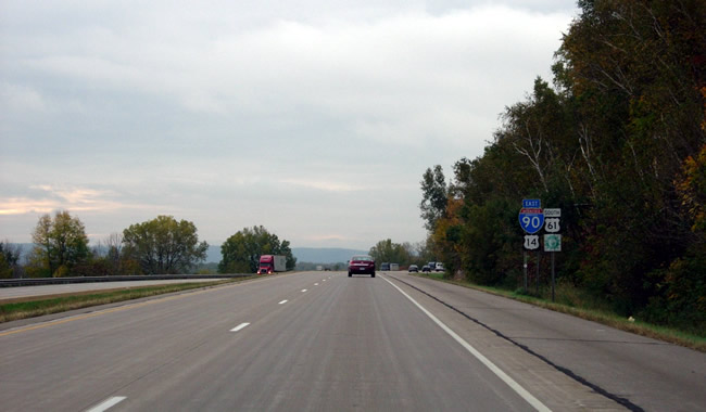
Route markers.

River bluffs along U.S. 61/I-90/U.S. 14.

Getting closer to the south junction with I-90...

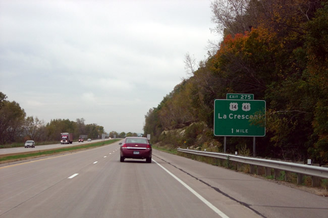
Approaching the U.S. 61/U.S. 14 exit to La Crescent. Also note the Great River
Road marker on the far right.

At the actual split with I-90. When this stretch of I-90 was first completed
in 1964, all traffic had to exit here. The interstate bridge to Wisconsin
wasn't completed until 1967.

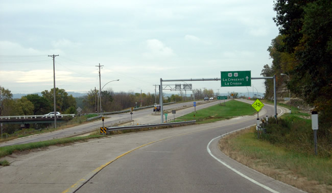
Exiting from I-90 towards La Crescent and La Crosse. Note the ramp from U.S.
61/U.S. 14 northbound to I-90 eastbound on the far left (with the silver SUV).
A sign indicating the connection to State Highway 16 in La Crescent is also
visible in the center of the photo.
>> Next Page
>> Page Index
- Page 1 - Southbound on I-90
- Page 2 - Southbound, La Crescent and the Jct. with State Hwy. 16
- Page 3 - Southbound, From La Crescent to the Wisconsin State Line
- Page 4 - Northbound, From the Wisconsin State Line to La Crescent
- Page 5 - Northbound, At the South Jct. with I-90 Near Dresbach
- Page 6 - Northbound, From Dakota to La Moille
- Page 7 - Northbound, From La Moille to Homer
- Page 8 - Northbound, From Homer to the Jct. with State Hwy. 43 at Winona
- Page 9 - At Winona, From the Jct. with State Hwy. 43 to Gilmore Avenue
- Page 10 - From the Jct. with U.S. 14 at Winona to County Road 32 at Goodview
>> Back to the Photo Gallery Index
>> back to top
