
 Historic U.S. 61: Old Road at Wildwood Lane
Old Road at Wildwood Lane
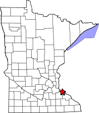
Located: Along the south side of U.S. 61/63 adjacent to the intersection with Wildwood Lane, about 0.65 miles west of the junction with Co Rd 21. Wacouta Township, Goodhue County.
Historic Context: Early concrete-paved highway constructed by the Minnesota Highway Department.
Length: About 0.50 miles.
Constructed: Graded in 1924, paved with 18' of concrete in 1925.
Bypassed: 1954, by construction of a new alignment.
Also Part Of:
 1935-1954
 1924-1934
Status: About 150 feet of original concrete pavement is exposed, but closed to traffic. The rest of the pavement has been removed or buried - the grade is still visible.
Access: Easily accessible from Wildwood Lane off of U.S. 61/63.
More U.S. 61 Articles
North >> 271st Street, Wacouta Township
South >> Hillside Drive, Wacouta Township
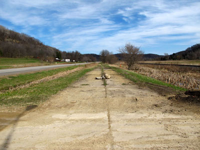
The remains of a piece of the original paved highway between Lake City and Red Wing survive along the south side of the modern highway at Wildwood Lane. No longer in use for anything, the concrete is slowly crumbling away. At either end of the surviving pavement are remains of the old road's grade where the pavement has been removed.
Map

Photos - taken in April, 2011

Looking west on the old pavement as it crosses Wildwood Lane. Modern U.S. 61/63 is on the right. The remains of the grade continue on ahead until running into a grove of trees and underbrush.

Looking southeast down the pavement as it parallels the modern highway. Note the rudimentary roadblock, consisting of a few chunks of concrete tied together with rebar.

The remains of the old grade eventually peter out as they approach the junction with Co Rd 21 (aka Flower Valley Road). However, another very small piece of pavement makes an appearance at this small-pull over area.
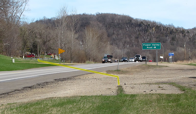
A closer view of the tiny section of old pavement. A tiny bit of superelevation in the pavement indicates the location of a shallow curve that brought it in line with what is now Hillside Drive (on the left), another surviving piece of the old road. The yellow line approximates rather crudely the path the old highway once took (the actual distance to the traffic barrier is 700 feet - the depth of field of the photo squeezes the perceived distance).