
 Historic U.S. 61: Gitchi Gami Trail at Chapin's Curve
Gitchi Gami Trail at Chapin's Curve
Located: Along the east side of State Hwy 61, approx. 3.5 miles to 4.25 miles south of Beaver Bay, in Beaver Bay Township, Lake County.
Historic Context: Part of the original North Shore Scenic Highway constructed in the 1920's.
Length: 0.60 miles (0.75 miles with temporary connection built in 1986 during construction).
Constructed: 1924
Bypassed: 1987, by construction of a new alignment.
Also Part Of:
Status: Rebuilt into a paved recreation trail.
Access: Public, no motorized vehicles. Best accessed by bike from either Split Rock State Park or Beaver Bay.
More U.S. 61 Articles
North >> Pine Bay Loop
South >> Split Rock Lighthouse Overlook

A historic section of Highway 61 once known as "Chapin's Curve" is now part of the Gitchi Gami Trail.
Situated between Split Rock Lighthouse and Beaver Bay, Chapin's Curve was a series of three very sharp turns combined with a steep hill built as part of the original north shore scenic highway in 1924. The road here was not replaced until a project between 1986 and 87 constructed the current highway further away from Lake Superior, smoothing the curves and flattening the hill.
Map
Key
- Blue = Repurposed/rebuilt into the Gitchi Gami Trail.
- Orange = Lost alignment, removed.
- Yellow = Temporary Connection Built in 1986, rebuilt into the Gitchi Gami Trail.
Photos - taken in April, 2010.

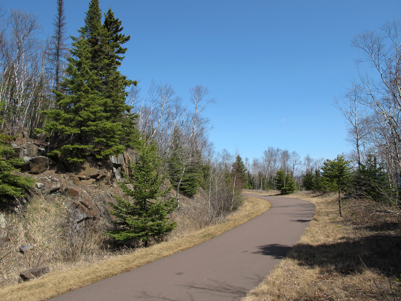
On the Gitchi Gami Trail where it enters the old right-of-way of Highway 61 at the south end of Chapin's Curve. The highway built in 1986/87 to replace it is on the left.
The southern-most (and sharpest) turn on Chapin's Curve, looking north.
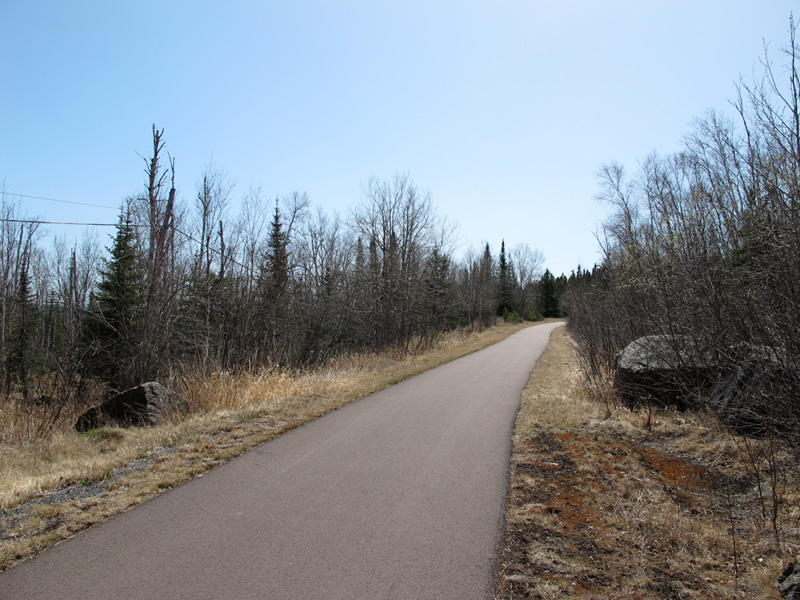
Looking back to the south on the short straight-away between the southern-most curves.

Looking north where the old road grade runs into the embankment below the new highway. The section of the trail ahead running along the bottom of the embankment was built as a temporary road for auto traffic during the 1986/87 construction.
Looking south after rejoining the old road-grade towards the north end of the temporary connection built to bypass the road-fill construction in 1986/87.
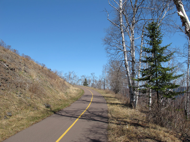
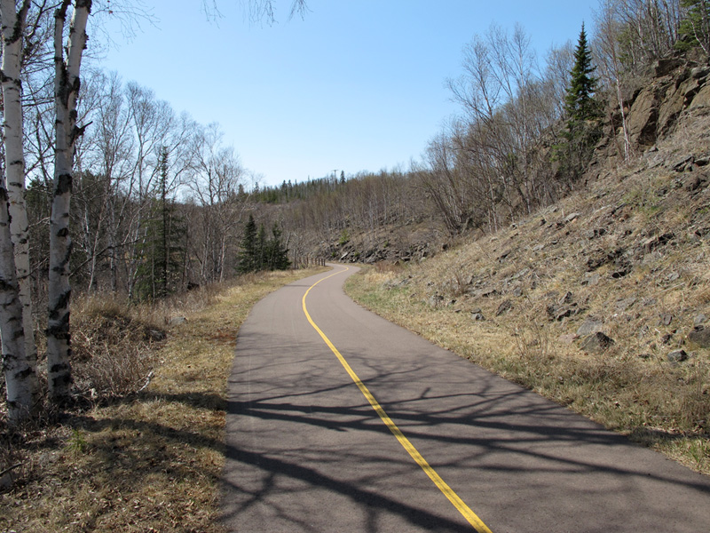
Northbound, ascending the final hill and turn on Chapin's Curve.
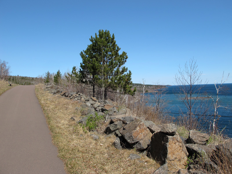
View of Lake Superior from the old road grade towards the north end of the surviving section. Gull Rock is visible on the right.
Sources
- MNDOT. Construction Project Log: Control Section 3806
- Minnesota Highway Department. Construction Plan for Trunk Hwy No. 61-1 Between Little Marais and Two Harbors: S.P. 61=1-01, June, 1923.
- Minnesota Department of Transportation. Construction Plan for Grading, Gravel Base, Bituminous Surface, Bit. Shoulders & Erosion Control, Located on T.H. 61 From 3.2 Miles So. of Beaver Bay To 4.3 Miles So. of Beaver Bay at Split Rock River: S.P. 3806-43, December 6, 1985.