Historic U.S. Highway 8, Minnesota
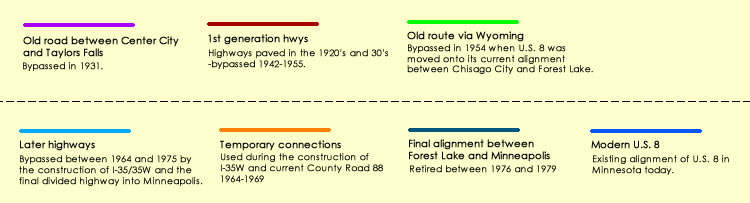
Surviving historic alignments are shown along their approximate center-line when bypassed (see explanation below for color codes). Click on the lines for bypass dates and other historic information.
Historic information was taken from MnDOT construction logs, highway plans, and right-of-way maps, plus official highway maps and historic aerial photos.
Alignment lines were drawn using Google Earth. Map powered by the Google Maps API.