

 Historic U.S. Highway 65, Minnesota
Highway 149 (The High Bridge Route)
When U.S. 65 was first marked in 1926 it followed what is now the State Highway 149 corridor, aka the "High Bridge Route" through what are now the suburbs of northern Dakota County to St. Paul. The road in use at the time was one of the first highways to be paved in the state, completed as far south as the current West Publishing complex in Eagan in 1920 as a county job, and the rest of the way to Robert Trail (now Highway 3) by the Department of Highways in 1922 as part of State Route 1. The road was also part of the famous Jefferson Highway prior to being added to Minnesota's original trunk highway system.
U.S. 65 was moved off of the High Bridge Route onto Robert Trail in late 1931, after which the old road was marked as a series of routes until becoming State Highway 149 in about 1980.
Most of the corridor has been rebuilt to the point where it would be unrecognizable to someone from the 1920's. However, north of Highway 110 the old road grade has never been fully reconstructed, allowing it to retain an appearance close to what earlier motorists would have encountered.
Smith Avenue, West St. Paul and St. Paul.
Smith Avenue on St. Paul's west side once fed traffic in and out of the south side of the capitol city towards Farmington and points south. It was reached via the "High Bridge" over the Mississippi River. The bridge in use in the 1920's had been originally constructed in 1889 and partially rebuilt in 1904 after being damaged by a storm. It was replaced by the current bridge in the mid 1980's (the old bridge was just southwest of the current structure).
Traffic on U.S. 65 would have shared Smith Avenue with streetcars between Annapolis Street and George Street (the streetcars did not cross the High Bridge). The tracks were removed in the early 1950's.
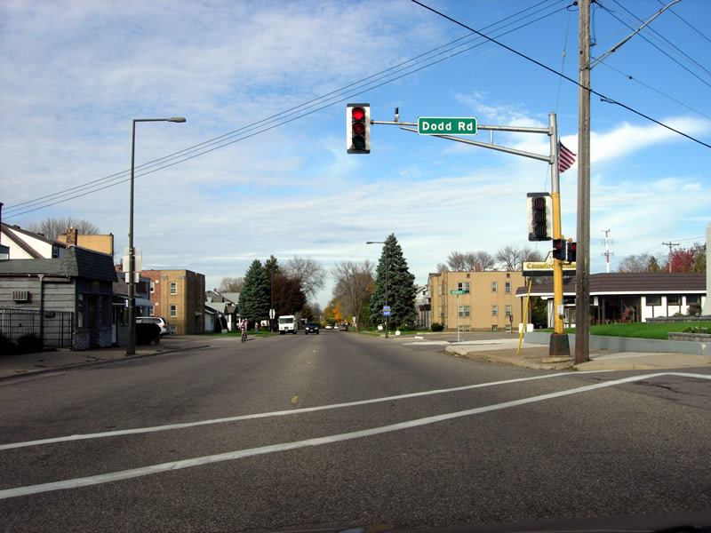
Looking north down Smith Avenue from Dodd Road in West St. Paul.
Photo from October, 2007.
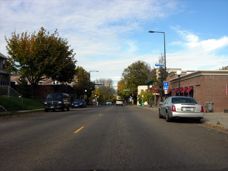
Approaching the intersection with Annapolis Street, also the city limits of St. Paul. Photo from October, 2007.

Old commercial buildings at the intersection of Smith and Annapolis, once the southern end of the Cherokee Heights street car line.
Photo from September, 2005.
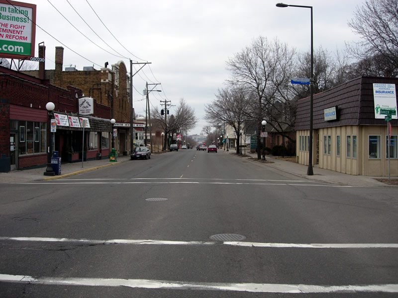
On Smith Avenue in St. Paul, with the state capitol visible in the distance. Also note the the sign on the lamp post on the right marking the "High Bridge Route".
Photo taken in March, 2006.
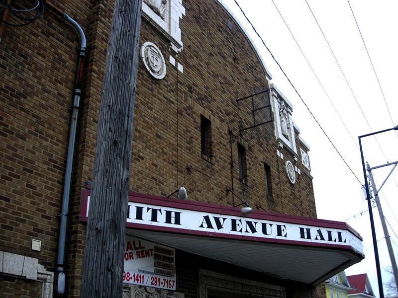
Close-up of Smith Avenue Hall.
Photo taken in March, 2006.
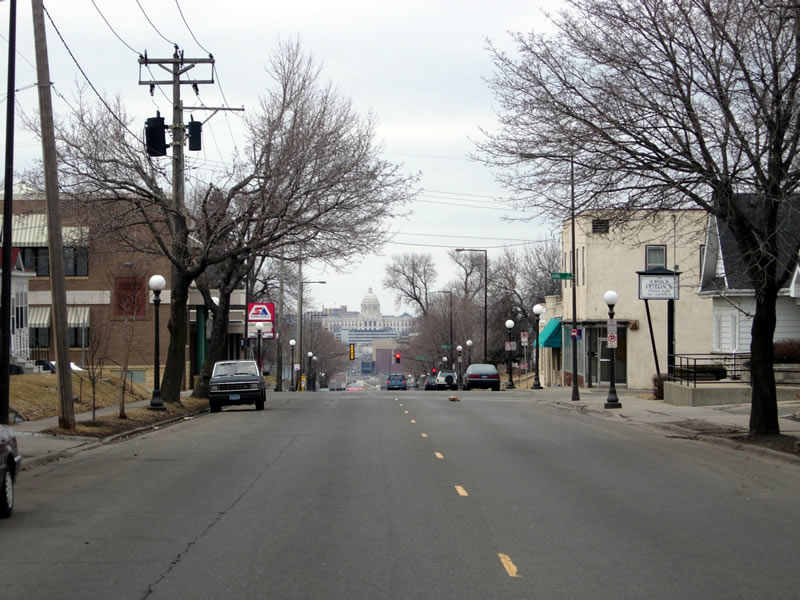
Another view of the state capitol, whose front doors are aligned perfectly with what was once State Route 1, later U.S. 65.
Photo taken in March, 2006.
Dodd Road, Mendota Heights
Dodd Road through Mendota Heights is the most intact portion of the old highway, especially north of Highway 110. The current Dodd Road is a paved incarnation of one of Minnesota's most historic roads, originally built as little more than blazed trail between St. Paul and St. Peter in the mid 19th century.

Northbound on Highway 149, aka Dodd Road.
This section has barely changed since the 1920's. Photo from October, 2007.
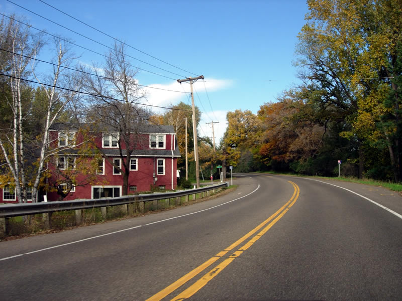
Photo from October, 2007.
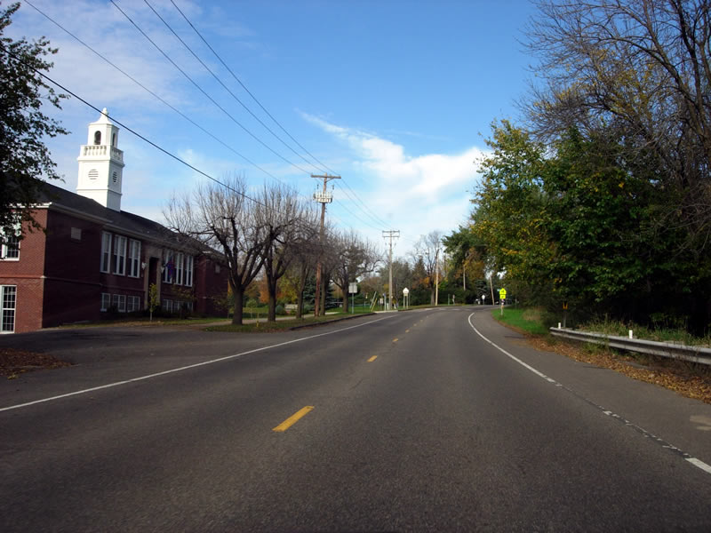
Photo from October, 2007.
Westcott, aka "Radio Center"
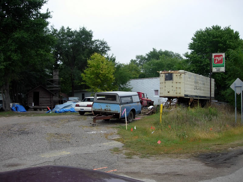
Junk piled around the remains of an old gas station along Highway 149 in Eagan, shown on old maps as "Westcott" or "Radio Center".
Photo from September, 2005.

The area a couple of years later during the reconstruction of Highway 149.
Photo from June, 2007.
Junction of Jefferson and Robert Trails

Approaching the south end of Highway 149 at the junction with Highway 3. Photo from June, 2007.
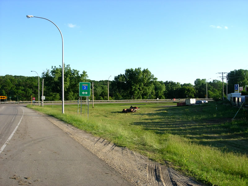
At the junction with Highway 3, looking southwest. The large empty field on the right was once occupied by the original paved highway, completed in 1922. The original road was curved here in order to pass under a set of railroad tracks just to the west. Photo from June, 2007.
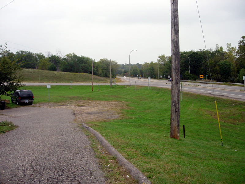
Another view of the junction, looking east from a nearby convenience store. The junction was rebuilt to its current configuration in 1977. Photo from September, 2005.
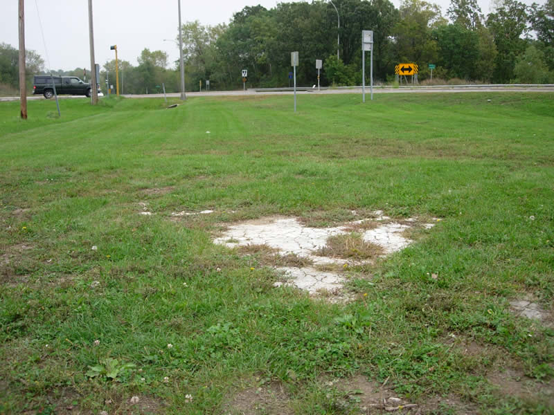
Possible remains of the original concrete pavement. Photo from September, 2005.