 Historic U.S. Highway 65: Old 65 Between Albert Lea and Geneva
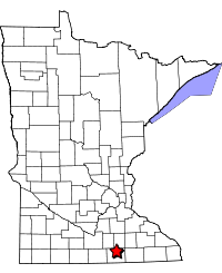
Old 65 Between Albert Lea and Geneva
Located On:
- Freeborn County Road 45 between U.S. 65 at Albert Lea and County Road 31/T.H. 251 at Clarks Grove.
- 780th Ave between Co Rd 45/T.H. 251 at Clarks Grove and the end of pavement at I-35.
- On County Road 45 between the curve on the east side of I-35 and the junction with County Road 47 just north of Geneva.
Historic Context: 1st Generation Concrete Highway built by the Department of Highways.
Length:.13.2 miles
Constructed: Road graded in 1928, graveled in 1929. Paved with 20' concrete 1929-1930.
Also On:
Bypassed: By construction of Interstate 35. Section between Geneva and Clarks Grove retired in 1967; section between Clarks Grove and Albert Lea retired in 1971.
Status: Most repaved and widened on the same alignment. About 0.85 miles north of Clarks Grove on 780th Ave repaved but intact. About 0.47 miles lost.
Access: All public. South end accessible at jct. of Co Rd 45 with U.S. 65 at Albert Lea. North end at the junction of County Roads 45 and 47 just north of Geneva.
More U.S. 65 Articles
North >> Old Road at Clarks Grove
South >> Stevens Street, Albert Lea
The old U.S. 65 corridor in north-central Freeborn County is known today as County Road 45, which runs parallel with I-35 for about 13 miles through the towns of Clarks Grove and Geneva.
Developed between 1928 and 1930, the old road was built as part of Minnesota's original trunk highway program and paved with 20 feet of portland cement concrete, the highest standard in the state at the time.
The old pavement escaped any reconstruction or modernization until the construction of I-35 in the late 1960's and early 70's. The freeway crossed the old right-of-way at one point just north of Clarks Grove, but was otherwise built far enough away to allow the old corridor to remain intact.
None of the original concrete pavement remains exposed today. Most of the road has been widened to modern standards,and is well maintained. Only one section just north of Clarks Grove (780th Avenue) has escaped reconstruction, but has been covered with a new layer of asphalt.

Photo Tour
Taken by the author in July, 2010 and August, 2011.
We start the tour at the south end of the old highway - now the junction of modern U.S. 65 with County Road 45 on the northeast side of Albert Lea. U.S. 65 formerly curved to follow County Road 45 north to Clarks Grove instead of continuing onto Interstate 35 (see map below).
The path of the original paved highway is represented in the map above by a red line (mouse over the image to see how the area looked in 1938). Note how much the area has changed with the addition of I-35 and the divided highways now in use by U.S. 65 and County Road 46.

The junction of U.S. 65 with County Road 45, looking north, with the modern highway in the foreground and the old road in the background on the left.

The first County Road 45 marker after turning off of U.S. 65.
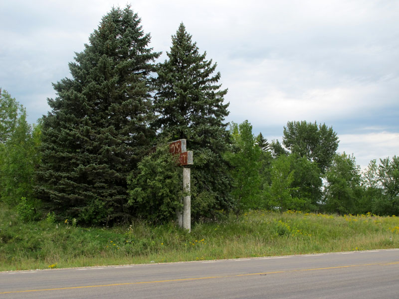
The remains of a mysterious sign poking out from a grove of trees just north of town on County Road 45.
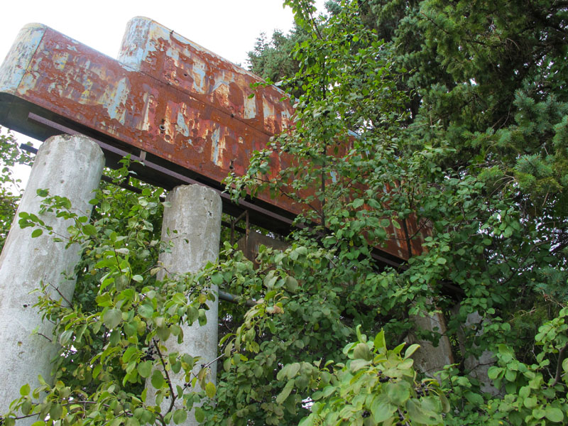
A closer view of the rusting sign. This was apparently the sign for a BONLAND'S(?) SUPERMARKET...

....but a closer inspection reveals the remains of neon bulbs that spell out "Vacancy", which would indicate that this was instead the sign for some sort of motel.

One of the few remaining neon tubes on the sign, which mysteriously does not line up with letters below.
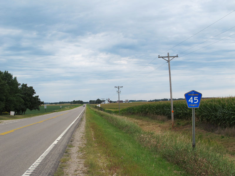
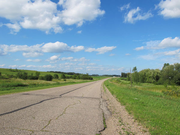
Northbound on County Road 45 between Albert Lea and Clarks Grove.
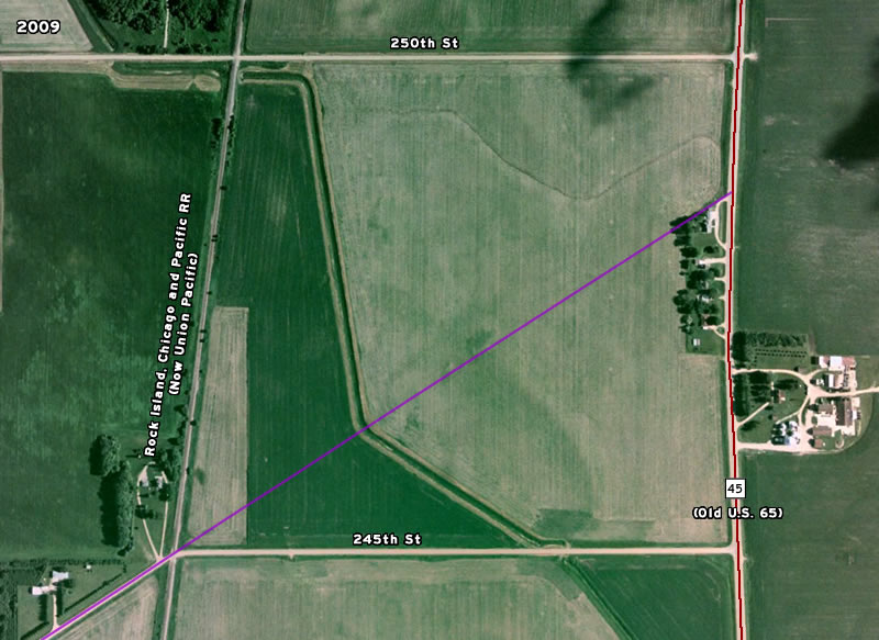
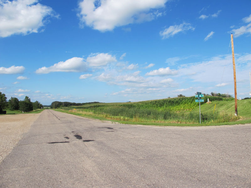
Just after passing a small cluster of houses between 245th and 250th Streets, Old 65 enters the corridor of the original county road that preceded its construction in the late 1920's (the original road's path is shown in purple on the map above). Old 65 was built along the same right-of-way as the old county road until it arrived at the south side of Clarks Grove.

Approaching Clarks Grove from the south.
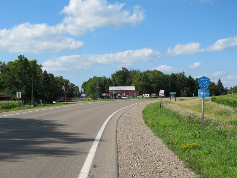
At the junction with County Road 24 on the south side of Clarks Grove, where the old highway curves to bypass the center of town. The original county road from before the 1920's construction continued straight ahead into town.
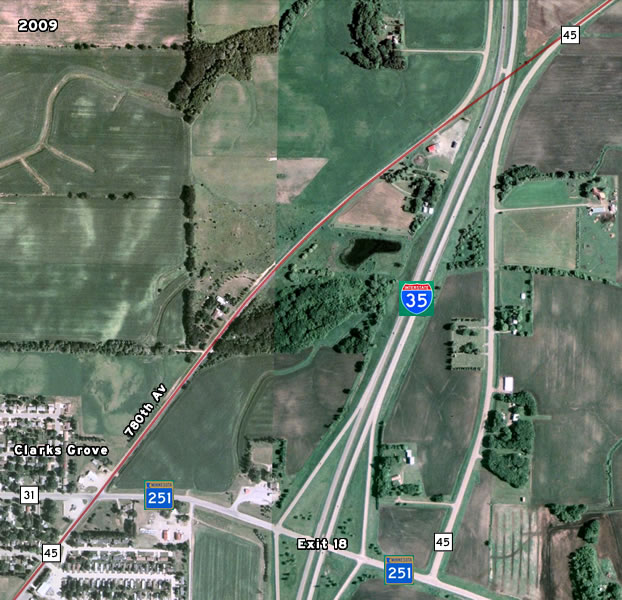
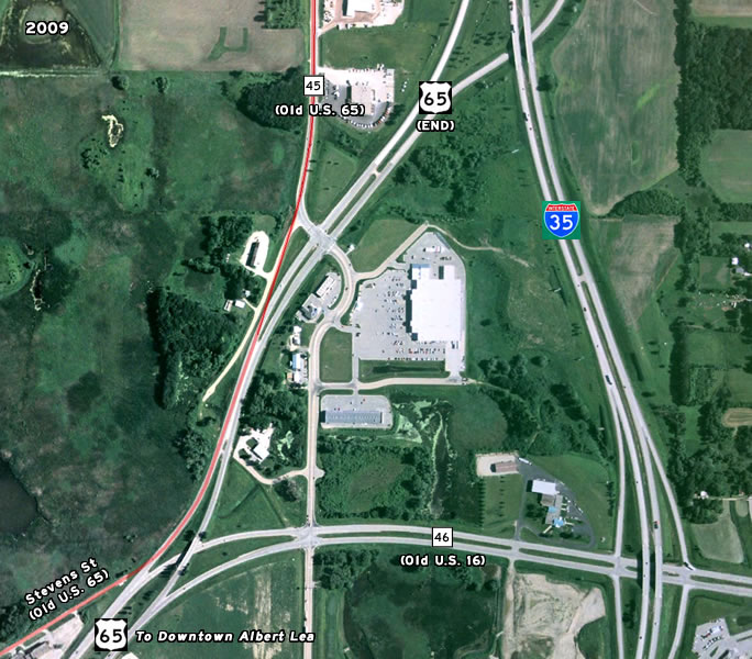
Just north of Clarks Grove the old highway met with I-35, which was constructed directly across the old right-of-way, cutting the road in two. From 1967 to 1971, I-35 was only completed only as far south as this crossing, and a temporary ramp fed traffic from the freeway onto what is now 780th Avenue. After the freeway was completed in 1971, the section of the old road north of Co Rd 31/T.H. 251 became disconnected with the old route, and was thus not rebuilt, although the old concrete pavement was covered with a layer of asphalt. The image above shows the alignment of the highway with a red line (mouse over the image to see what it looked like in 1938 when the old highway was still intact).
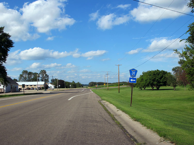
The junction with County Road 31 (and T.H. 251) on the east side of Clarks Grove.
Looking north from the intersection of County Road 45 with County Road 31 and State Highway 251 down 780th Avenue. The road north of this intersection, no longer part of a county road, has been repaved but has otherwise not been rebuilt since being bypassed by I-35 in 1971.

The old highway as it leaves Clarks Grove on the former route to Geneva.
780th Avenue were it runs into I-35, looking northeast. Across the freeway you can see the remainder of the old highway (Co Rd 45). This was once the south end of I-35 from 1967 to 1971.

Entering the town of of Geneva on County Road 45 northbound.

Downtown Geneva on a summer sunday evening.
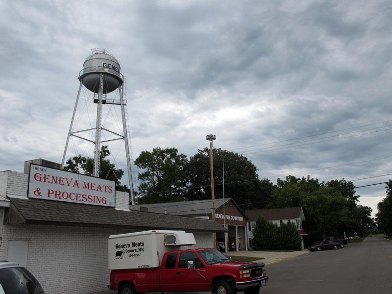
Geneva water tower, with "Geneva Meats & Processing" and the Geneva Fire Department, looking northeast down Main Street from the old highway.
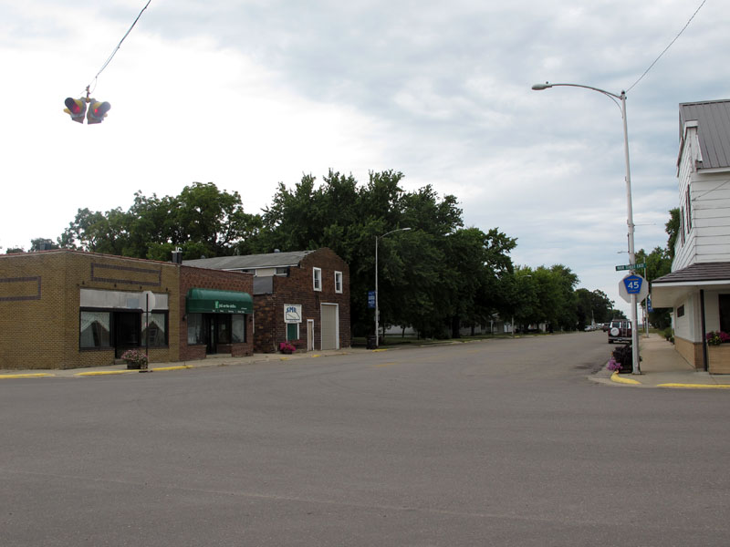
Another view of downtown Geneva, looking north on County Road 45 at Main Street.
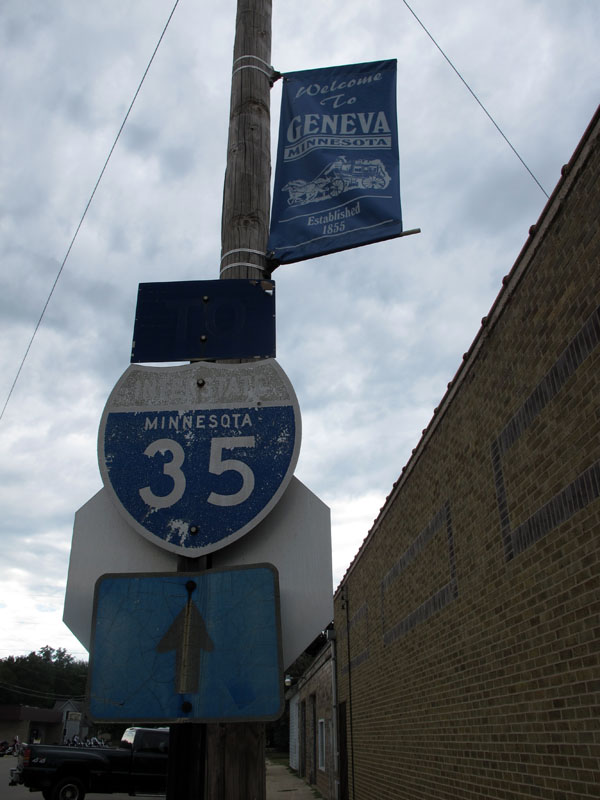
An old-style I-35 shield in Geneva (looking west down Main Street from the old highway).
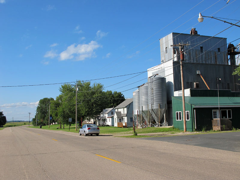
County Road 45 on its way out of Geneva.
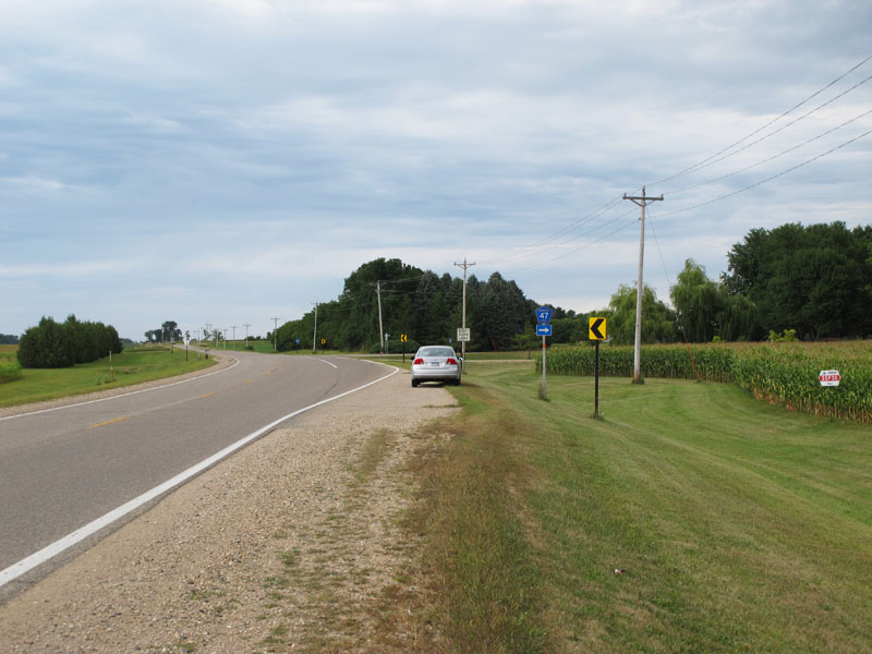
The junction of County Road 45 with County Road 47 just north of Geneva.
Both roads at this junction are former alignments of U.S. 65 (both to be covered in future articles).
Back to >> U.S. 65 Photo-Articles
Sources:
- Construction Project Log Records: Control Sections 2405 and 2480.
- Construction Plan: State Project 65=1-51, approved 9-17-1927.
- Construction Plan: State Projects 2405-09, 2408-07, 2480-10, approved 1/26/1968.