
 Historic U.S. 61: Spiral Bridge and Approaches, Hastings
Spiral Bridge and Approaches
Located In: City of Hastings and Denmark Township, Dakota and Washington Counties.
Bypassed: 1930 (North Approach), 1951 (Bridge and South Approach)
Length: 1.86 miles
Also Marked As:

1921-1930 (North Approach), 1921-1934 (Bridge and South Approach)
The historic and "one-of-a-kind" Spiral Bridge was the original structure to carry U.S. 61 over the Mississippi River at Hastings. Constructed in 1895, the bridge served the citizens of Hastings for 56 years until it was demolished in 1951 (its replacement, the Hastings High Bridge, is itself scheduled to be replaced in 2010). Although the bridge is long gone, pieces of both the south and north approaches have managed to survive.


The bridge as it appeared in the early 20th century.
Construction
The Spiral Bridge was completed in 1895 as a wagon bridge. The defining spiral ramp on the south end allowed it to be constructed with enough clearance to allow river traffic to pass underneath while insuring that it didn't bypass the main commercial area on 2nd Street by extending too far south .
The south approach was made up of two blocks of city streets in old downtown Hastings, including 2nd Street between Vermillion and Sibley Streets, and Sibley Street from 2nd to the spiral ramp. Both streets were paved with asphalt on top of concrete in 1921.
The old north approach road was shown on right-of-way maps as the "St. Paul - Hastings Wagon Road". It wound its way north out of the river valley to a point just south of the current junction with U.S. 10. Records show that it was still gravel when U.S. 61 was first marked in 1926.
Bypass History
Bypassing the Spiral Bridge and its approaches took over 20 years to accomplish.
The first step was the construction of a new north approach along the alignment still in use by U.S. 61 today. Construction took place between 1929 and 1931 (the grade was completed in 1930, paving was completed in 1931). The new approach was much straighter, and bypassed two at-grade rail crossings on the old road via a set of overpasses. The road was aligned to meet a proposed new bridge over the Mississippi straight-on (construction plans from the late 1920's show its future alignment). However, it was not constructed, and a short temporary connection had to be built to the Spiral Bridge.
The replacement for the Spiral Bridge was not constructed until after World War 2. The new Hastings High Bridge, still in use today, was opened to traffic in 1951. It was aligned to feed traffic directly onto Vermillion Street, bypassing the old jog through downtown Hastings on 2nd and Sibley. The historic spiral bridge was demolished soon after, a decision that has haunted the citizens of Hastings ever since.
Current Status
As already mentioned, the most historic part of the old alignment, the spiral bridge, is long gone. Its south approach on 2nd and Sibley is still fully intact, with the exception of the old turn onto Vermillion Street, now occupied by the south end of the current bridge (access to 2nd is accomplished via ramps leading south from 3rd Street, see inset 1, below).
Inset 1: South Approach in Downtown Hastings
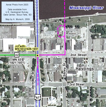
Only a small portion of the old north approach has survived. It is accessible from the first turn north of the current bridge. The old road runs just to the west of the current highway through the river bottoms, ending at the first set of railroad tracks (this road is possibly private - it shows up on major online mappings sites, but not on MnDOT's city map of Hastings). The surviving section now provides access to a private marina, a lone homestead, and maintenance access for the local railroads. It is still gravel. The remainder of the road ascending out of the river valley has become overgrown and is inaccessible to vehicle traffic. Few signs are visible on aerial photos today. It has proven difficult to accurately map the alignment of the north end of the old road. However, it seems likely that its alignment passed through what is now a private farm. In fact, I am pretty sure that the house on the farm was constructed directly on top of the old grade. Part of the driveway to the farm also appears to have been built on the old grade (the north end of the driveway was constructed in the late 1950's when U.S. 61 was upgraded into a divided highway - see inset 2, right). |
Inset 2 - North End Near U.S. 10 |
Photo Tour - Photos were taken in July, 2006 unless otherwise noted.
Downtown Hastings

Looking east down 2nd (Main) Street towards the modern U.S. 61 overpass. This was the site of the junction of U.S. 61 with old State Highway 53 until 1931. Note the signs pointing the way to U.S. 61 and the Great River Road
on the far right. Photo taken October, 2005.
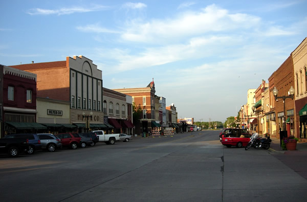
Another view, looking east on 2nd (Main) Street through Hastings' historic
business district. Hastings' old downtown between Vermillion and Ramsey Streets was added to the national register of historic places in 1978.

Looking northeast at 2nd Street and Sibley. Traffic on U.S. 61 northbound
would have turned left here to approach the Spiral Bridge.
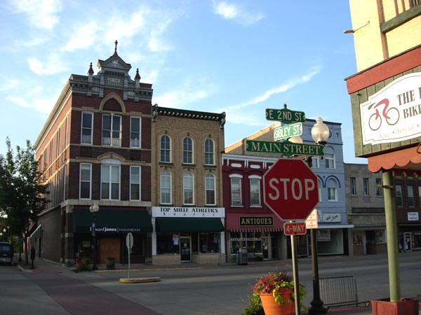
Another view to the northeast at the corner of 2nd and Sibley (just because
I love old 19th century commercial buildings).

Looking north on Sibley Street, the old connection to the spiral bridge.

A marker commemorates the spiral bridge at the north end of Sibley Street
in Veterans Memorial Park. The reflection of its replacement is visible in
the polished granite (looks a lot like a gravestone doesn't it?).

The old spiral bridge has become the de facto symbol for the city of Hastings,
appearing even on city vehicles.
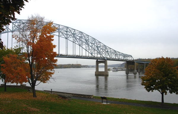
A view of the modern U.S. 61 bridge at Hastings, looking north across the
Mississippi. The stone structures in the foreground (lower left) mark where
the old spiral bridge was positioned. The site of the spiral ramp is now occupied
by a VFW. Photo taken October, 2005.
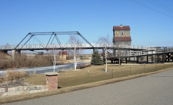
A scaled down replica of the spiral bridge exists at the Little Log House
Pioneer Village, just a couple of miles east off of U.S. 61, south of Hastings.
Photo taken in March, 2007.
Old North Approach Road

Looking south from the marina in the river bottoms towards the Hastings High Bridge. The old road ran straight ahead (the road itself is gone).
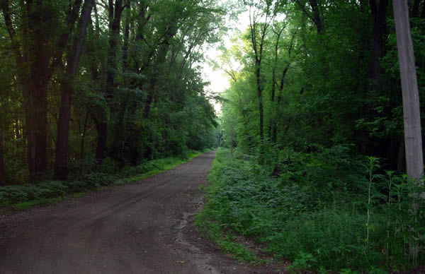
Looking north on the old "St. Paul-Hastings Wagon Road" from the connecting drive to modern
U.S. 61. The road is still unpaved. Photo taken in July, 2006.

Looking back to the southeast towards the marina. Photo taken in March, 2007.
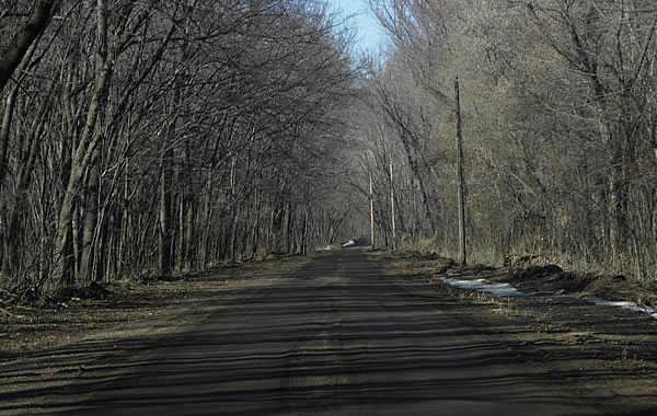
Another view, another season, looking north. Photo taken in March, 2007.

Looking north at the first set of railroad tracks. The original road curved
to the right here and continued across the tracks into what is now an overgrown
swamp. Photo taken in July, 2006.

