
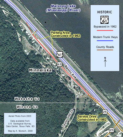
 Historic U.S. 61: Old Alignment at Minneiska
Old Alignment at Minneiska
Located In: City of Minneiska, Wabasha County
Bypassed: 1962
Length: 0.41 miles
Also Marked As:
 Until 1934
Part of the service drive at the small river town of Minneiska was once part of the original paved highway used by U.S. 61.
Construction
The road at Minneiska was graded in 1924 and paved with concrete (18 feet wide) in 1925 as part of the construction of the first paved highway between Minneiska and Kellogg.
Bypass History
The original paved highway between Minneiska and just south of Weaver was replaced by the construction of a new road in 1962 that would eventually become the modern four-lane expressway. One short section of the old pavement survived at Minneiska, and was incorporated into a service drive.
Although the roadbed for both the north and southbound lanes was finished, paving was limited to a temporary surface on one lane only. It wasn't until 1965 that the paving of both lanes was completed in conjunction with the reconstruction of the highway from Minneiska south to Minnesota City.
The construction at Minneiska altered the landscape dramatically. The project wiped out the old north half of town, including what was once Minneiska's main business district. Plans show that several stores, garages, homes, a post office, and a chapel had to be demolished to make way for the new highway. The population of Minneiska dropped from 134 in 1960 to 80 in 1970, a 40% decrease.
Current Status
The old road is now labeled as Benny Avenue, and also makes up the entirety of tiny Wabasha County Road 63. The old concrete has long since been paved over. Several sections of a retaining wall along the west side of the old road may be original.
Photo Tour - Photos were taken in May, 2008.
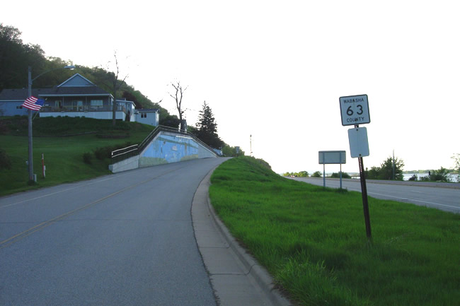
Looking north on Benny Ave / Wabasha County Road 63 at Minneiska. Note
the large concrete retaining wall painted with a mural on the left. There
was once a corresponding wall on the east side of the road, which effectively
put the old highway in a trench to reduce the grade on the hill on the south
side of town. The construction of the modern road removed the old east embankment
and the several houses situated on top of it.
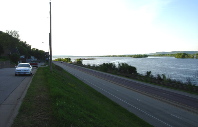
On top of the hill at Minneiska on the old highway, looking north, showing
the difference in elevation between the two alignments of U.S. 61.

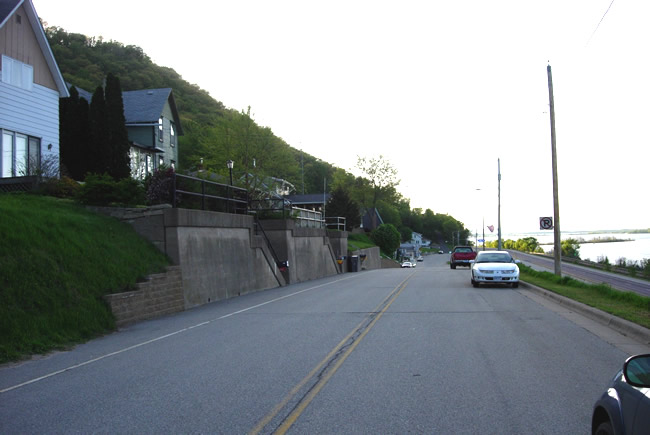
Looking back to the south from a bit further along the old highway.

Looking south on Bennett Ave, showing some of the old stone retaining walls.
More old concrete retaining walls and staircases.
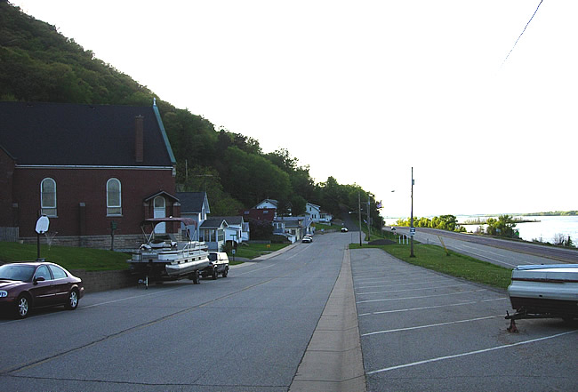
On the north side of the surviving portion of Minneiska. The old highway
curved to the right just ahead onto the right-of-way of the modern road.
The location of Minneiska's main business district was in the distance where
the modern road now runs. The parking area on the right was originally constructed
in 1962.
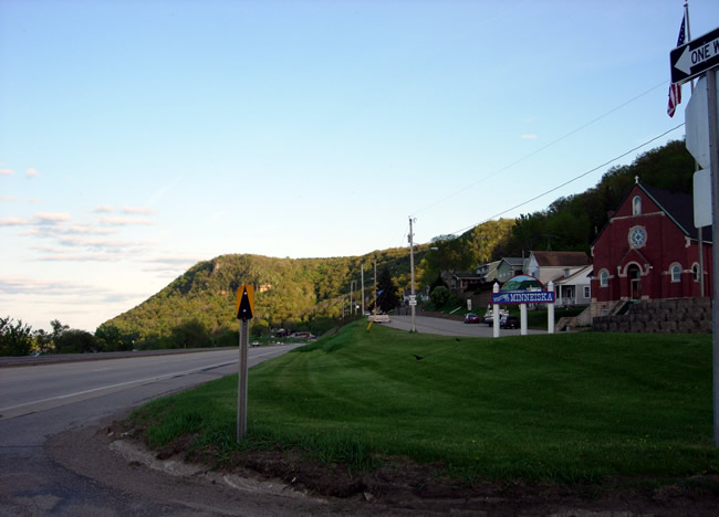
Looking back to the south at the north end of Minneiska.