
 Historic U.S. 61: Old Alignment Through Dakota and Dresbach
Old Alignment Through Dakota and Dresbach
Located In: Dresbach Township and City of Dakota, Winona County
Bypassed: 1964
Length: 2.46 miles
Also Marked As:
 1933-1964
 Until 1934
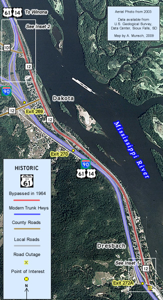
U.S. 61’s original alignment through the small river towns of Dakota and Dresbach survives just to the east of Interstate 90, running parallel with the freeway for about 2.5 miles. This is one of my favorite historic alignments of U.S. 61. It affords you close-up views of the Mississippi River bottoms, the rail line, and of course the towns of Dresbach and Dakota, all things usually missed when driving on the interstate.
Construction
The old road through the two towns was graded in 1924 and paved with concrete, 18 feet wide, in 1927 as part of the paving of the highway between Winona and La Crescent.
Bypass History
This section was bypassed by the construction of Interstate 90 through the Mississippi River valley in 1964. The choice of a more westerly alignment for the Interstate saved the towns of Dakota and Dresbach from destruction, but relegated them to being little more than names on an exit sign to passing travelers.
Current Status
The old alignment is now marked as part of Winona County Road 12 and as Riverview Drive. Although the alignment is intact, it has since been repaved and widened.
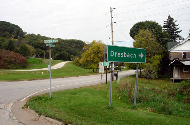
The southern end of the old alignment is at the intersection of Riverview Drive and Dickson Way at exit 272A and Riverview Drive (see inset 1, below).
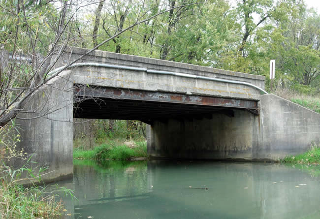
The north end of the old alignment is now the on-ramp to northbound U.S. 61/U.S. 14. The bridge over Dakota Creek at the south end of the ramp (bridge 3942, constructed in 1924) still survives, but is slated for replacement by the Winona County Highway Department (see inset 2, below right).
Inset 1 - Exit 272A at Dresbach |
Inset 2 - North ramp to modern U.S. 61/ U.S. 14 |
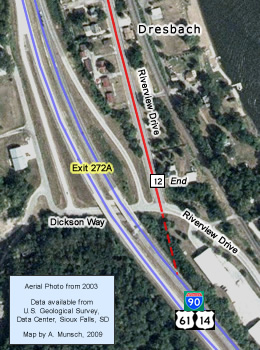
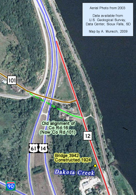
Photo Tour - Photos from October, 2007.
Looking northwest at the southern end of the old alignment at exit 272A. The
ramp onto the modern highway is visible on the left.
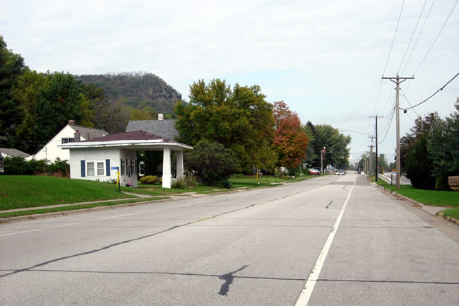
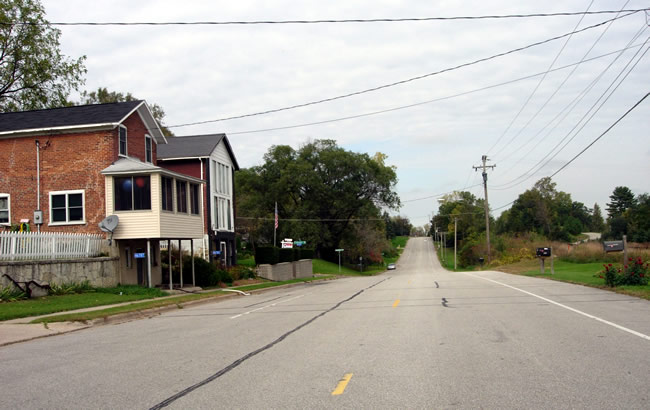
Looking north on County Road 12 towards Dresbach.
An old service station in Dresbach.
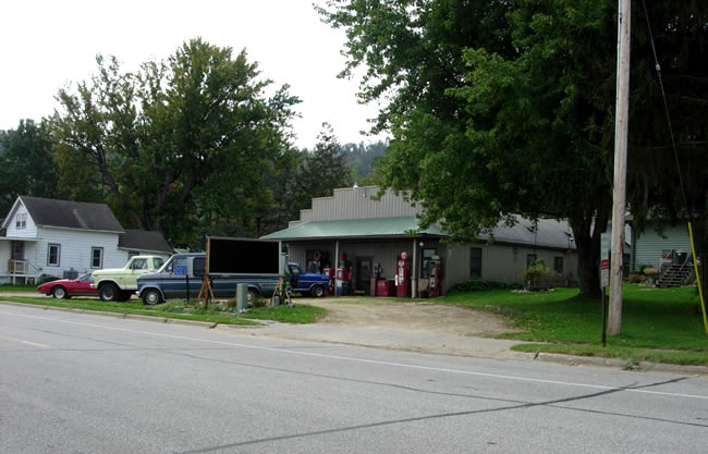
(Updated - Aug 6, 2008) - The gray building with the green awning
was once known as "Lloyd's Garage", and has been servicing vehicles
since at least the 40's (it also may have sold new cars in the 50's). Gas
was sold here until at least the 70's. The current owners, Tim and Peggy,
had the tanks removed when they acquired the building in the early 80's. (Thanks
to Tim and Peggy for the info!!!)
More views of Dresbach....
Leaving Dresbach...

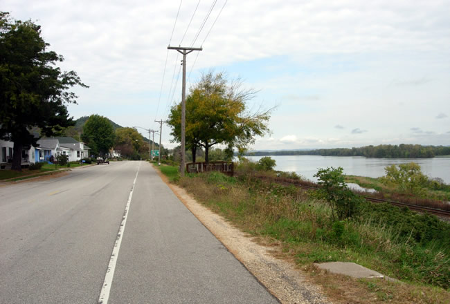
Metal crib walls keep the Interstate from collapsing onto the old road between
Dresbach and Dakota.

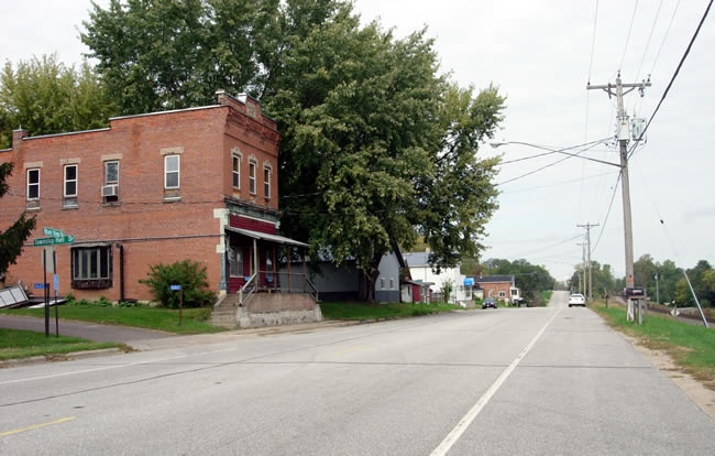
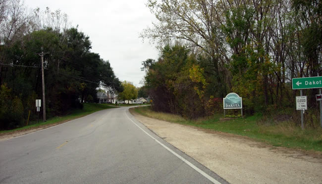
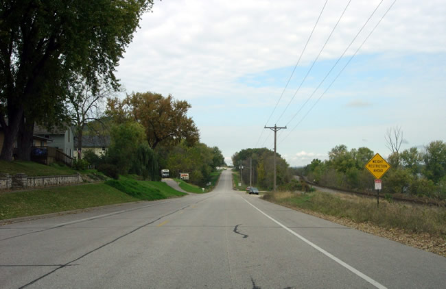
Approaching Dakota.....
Entering Dakota. Exit 270 from the modern Interstate intersects the old highway
here. Just ahead is the former site of bridge #3941.

The last curve into Dakota.
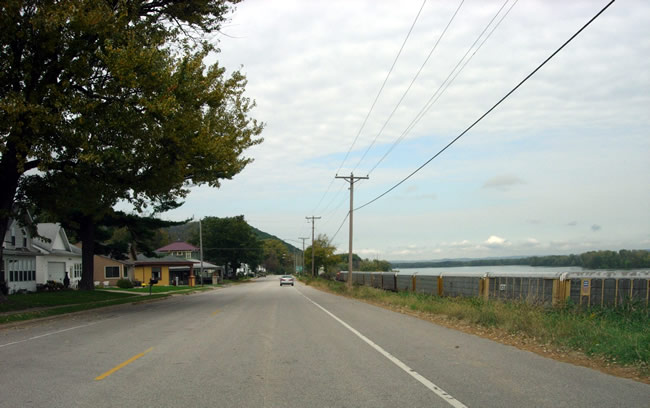
Looking north through Dakota. Note the passing train and the Mississippi River
bottoms.

Two old service stations still stand guard on old U.S. 61 at Washington Street.

The station on the south corner has been fully restored, complete with a vintage
fuel pump.
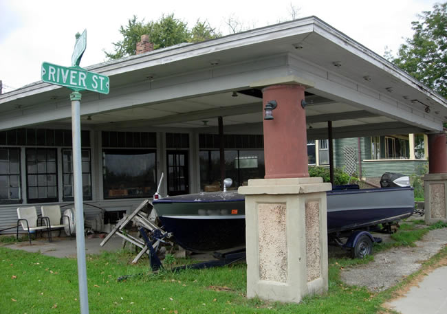
A close-up of the other old service station (now serving only boats apparently).
Another view to the north through Dakota.
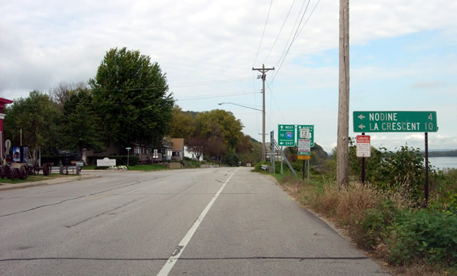
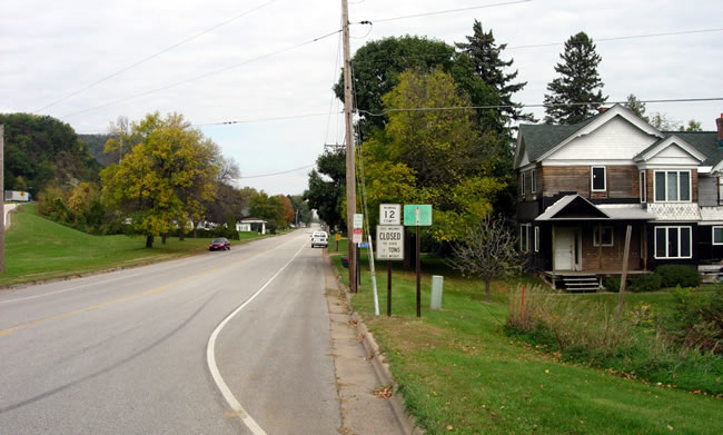
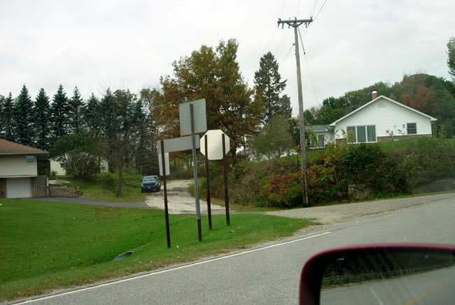
At the County Road 12 turn-off towards I-90 and exit 269 (Center St). Note
the slightly worn mileage sign on the right.
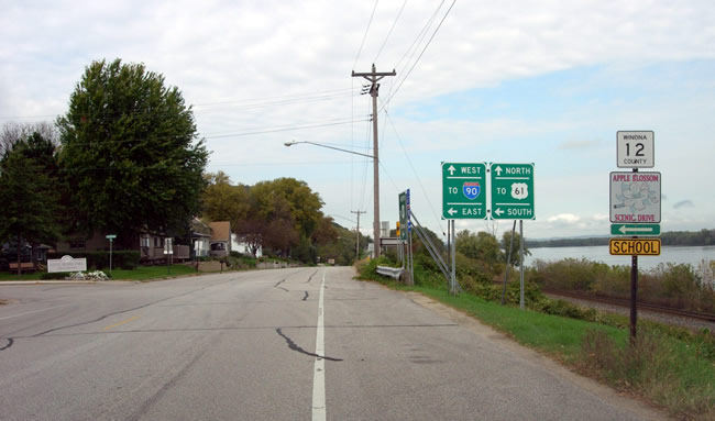
Another view from the same location, showing more route signage. Note the
marker for the Apple Blossom Scenic Drive.
Leaving Dakota, approaching Dakota Creek.
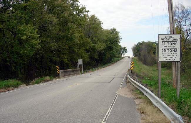
At bridge #3942, constructed in 1924 by the Department of Highways for what
was originally State Highway 3. Note the weight restrictions imposed on the
aging structure.
The bridge from the public water access, looking west.
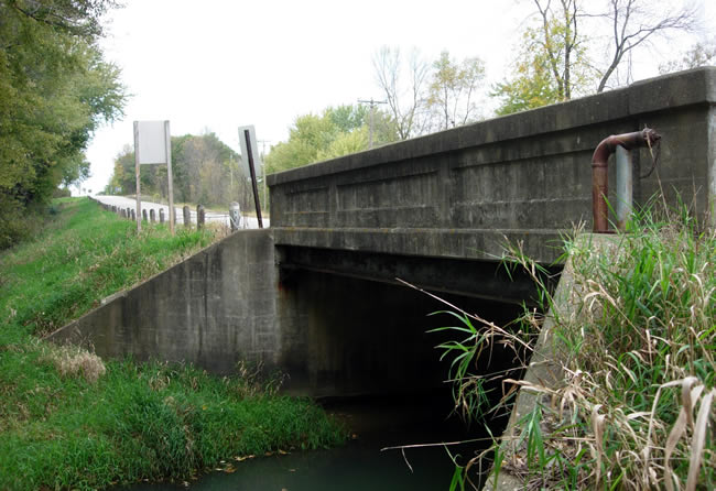
Another view, looking northeast.

Another view to the north across the bridge. The road north of Dakota Creek
was reconstructed in 1964 to serve as a feeder onto U.S. 61 / U.S. 14 northbound.
Looking west, just before the ramp onto U.S. 61/U.S. 14. The old road in the
center of the photo is the old east end of County Road 16, now County Road
101, which was bypassed due to the construction of the Interstate in 1964.

Looking north at the on-ramp to modern U.S. 61/U.S. 14 (note the lack of a
U.S. 14 marker). Also note the connection to westbound I-90 via County Road
101.