 Historic U.S. 61: Bridge Street, Minnesota City
Bridge Street
Located In: Minnesota City and Rollingstone Township, Winona County
Bypassed: 1978
Length: 0.92 miles
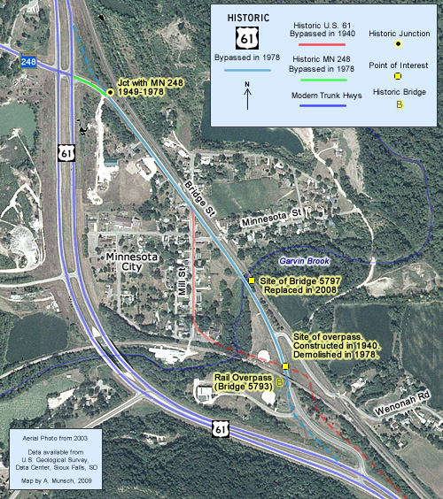
Brdge Street once served as the first Minnesota City bypass, carrying U.S. 61 around the east side of town. It was eventually replaced in 1978 by the current four-lane bypass to the west.
Construction
Bridge Street was constructed in 1940 to replace the original alignment of U.S. 61 on Mill Street, which ran through the middle of town. The new road was originally paved with concrete, 22 feet wide. A new bridge over Garvin Brook was also constructed. Garvin Brook's channel between the new and old bridges was modified and shored up with crib walls (these failed in a 2007 flash flooding event). Two stone arrowhead markers reading "Garvin Brook" were placed at each end of the bridge.
Two overpasses were also constructed on the southeast edge of town. The first was for the railroad tracks, finally getting rid of an at-grade crossing on the previous road. The second overpass was constructed for a connection between Wenonah Road and old bridge into town. One connecting ramp was constructed between the new highway and the connection, creating a crude grade-seperated interchange.
Bypass History
The alignment constructed in 1940 served U.S. 61 well into the 1970's. In 1978, the final stage of the La Crosse- Wabasha expressway was finally completed, including a new westward bypass of Minnesota City. The construction included the demolition of both the original bridge over Garvin Brook and the old Wenonah Road overpass. The rail overpass surivived.
Current Status
Bridge Street is still mostly intact north of the rail overpass, although the original concrete pavement has long since been paved over. The recent 2007 flooding event in southeast Minnesota caused a great deal of damage in Minnesota CIty. The bridge over Garvin Brook constructed in 1940 survived, but the north approach was washed out. The bridge was demolished and replaced in 2008.
Historic Junction:  1949-1978
The original junction with State Highway 248 (added to the trunk highway system in 1949) was located just to the east of the current junction at the north end of Bridge Street.
Photo Tour - Photos were taken in May, 2008.

Looking north at the entrance to the old Minnesota City bypass (Bridge St)
from modern U.S. 61 at the south end of Minnesota City. Note the "bridge
closed" sign.
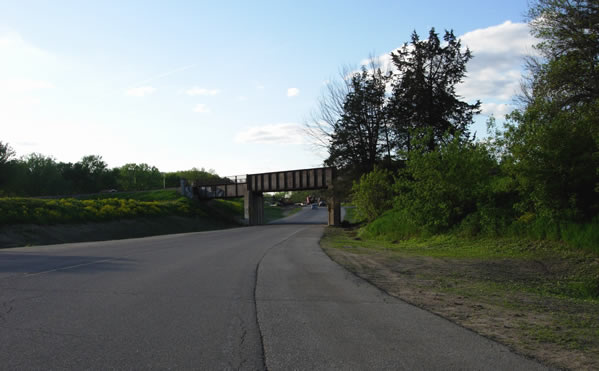
Approaching the old railroad overpass from the south.
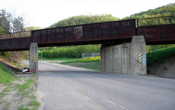
A closer view of the railroad overpass, looking back to the south towards
the modern highway. The bridge was constructed back in 1940. Note the stepped
bridge piers.
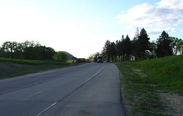
Looking back to the north on Bridge Street at the modern connection to Wenonah
Road. There was once an overpass bridge here that connected Wenonah Road with
the original bridge to downtown Minnesota City and Mill Street. It was removed
in 1978. The concrete pavement constructed in 1940 has been paved over.
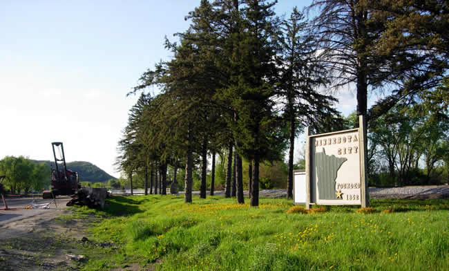
Minnesota City sign and historical marker, just south of the bridge over Garvin
Brook. Note the rail grade in the background. Construction
equipment was already in place for the replacement of the bridge.
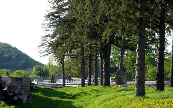
A closer view of an old arrowhead marker at the south end of the old bridge
over Garvin Brook. Roadside development plans from 1940 show that a total
of four of these markers were placed near the bridge, one on either side of
the highway on each end. They have all since been removed.
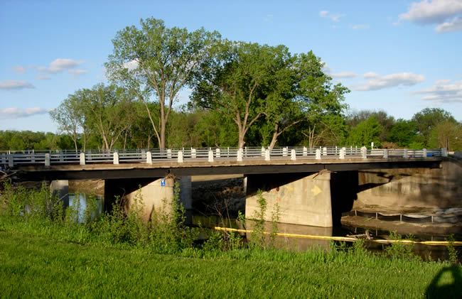
Bridge #5797 over Garvin Brook, constructed in 1940. Note the metal railings
with obelisk posts. These are similar in appearance to the railings on an
old highway bridge south of Dundas (see photo here).
The bridge was still rated as structurally sufficient before the 2007 flash flood.
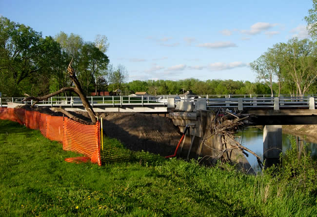
The wash-out on the north end of the bridge that forced its closure and subsequent
replacement. The bridge itself appears to still be fully intact.
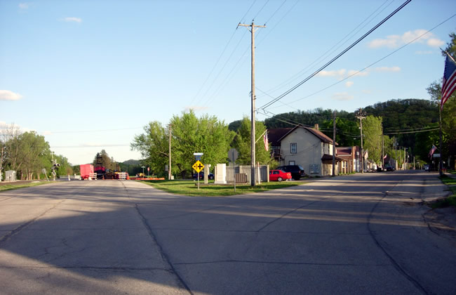
Looking south at the split between two old alignments of U.S. 61 through Minnesota City. The
original alignment, on the right, curved directly onto Mill Street. On the
left is the first Minnesota City bypass (Bridge St), constructed in 1940.
The barricades blocking the washed out north end of the bridge over Garvin
Brook are visible.
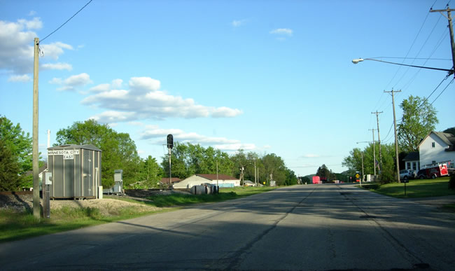
Bridge Street as it enters Minnesota City. Note the "Minnesota City East" railroad stop on the left.
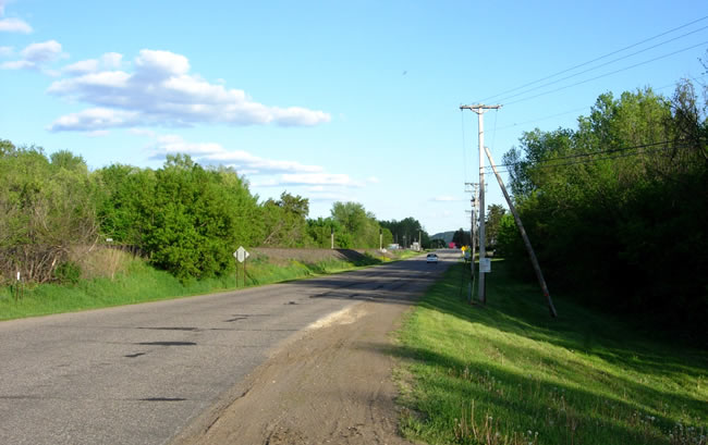
Looking southeast on Bridge Street from modern U.S. 61 on the north side of
Minnesota City.
