 Historic U.S. 61: Old Baptism River Bridge and Highway
Old Baptism River Bridge and Highway
Located: on the east side of State Highway 61 at the Baptism River, approx 0.65 miles south of Illgen City (jct. with Hwy 1). In Tettegouche State Park, Beaver Bay Township, Lake County.

Historic Highway Data
Historic Context: Part of the original North Shore Scenic Highway constructed in the 1920's.
Length: 0.17 miles intact (including historic bridge). Repaved.
Constructed: 1924
Bypassed: 1969, by construction of a new alignment.
Also Part Of:
Status: Intact, now part of the main driveway into Tettegouche State Park.
Access: Public, state park vehicle pass required. Otherwise accessible by pedestrians from the Baptism River Wayside Rest parking area.
Historic Bridge Data
Bridge #: 3459
Design: Main Span: 140' steel deck truss. Four additional spans: Steel deck girders, approx 60 feet each. 380 feet total. 19' wide roadway.
Constructed: 1923
Historic Context: Bridge built for the original North Shore Scenic Highway constructed in the 1920's.
Status: Restored in ca. 1985 and again in 2004. Deck has been widened and repaved. A wooden pedestrian walk has been added, plus new wooden railings.
Current Bridge
Bridge #: 38007
Design: Continuous welded steel beam, 4 spans (128', 155', 155', 128'), 42' 10" roadway with 2x5' sidewalks.
Constructed: 1968/69
Also On: 
Status: Open, rated as structurally adequate.
More U.S. 61 Articles
North >> Old Alignment at Illgen City
South >> Old Highway at Palisade Head
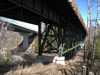
U.S. 61's original crossing of the Baptism River, plus a very short stretch of its old alignment, survive in what is now Tettegouche State Park.
The bridge and road were constructed in the 1920's as part of the original north shore scenic highway. The bridge had an only 19 foot wide driving lane, barely wide enough for two vehicles to cross at once. It somehow managed to remain in use until the late 1960's, when the Department of Highways finally realigned Highway 61 , replacing the bridge and improving the grade.
Map
Key
- Green = Intact
- Orange = Old alignment, removed.

The Highway Department had planned on improving roadside facilities at the bridge in 1948, when plans were drawn up for two parking areas (see above, northbound is to the left) at either end of the bridge, each to have a masonry wall and a small grass island separating it from the highway. The walls were never built, however, and the parking areas remained rudimentary paved parking lots with metal guard rails. The parking area on the north side of the bridge survived the construction, and is still there today. Plans from the 1980's label the parking lot as "fisherman parking".
When the bridge was finally replaced in 1968/69, plans show that it was to have been demolished, and a scenic overlook installed in its place at the old north approach (see plan below). This never came to pass, however,and only a new parking area on the site of the current rest area building was built.
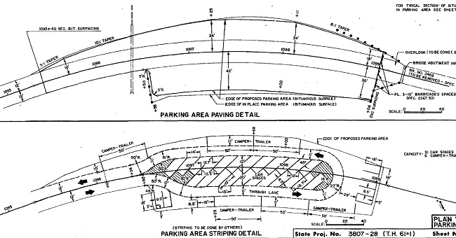
The Highway Department's second attempt at an overlook, plans from 1968. Again, none of this was built. Northbound is to the left.
The DNR eventually got a hold of the bridge in the mid 1980's and rehabbed it for use as the main driveway into Tettegouche State Park. The bridge's deck was widened towards Lake Superior to provide room for a pedestrian walkway and the road was repaved. It also appears that the bridge's original metal railings were removed, and replaced with rustic wood. MNDOT cooperated with the DNR on this project, building the current rest area and other service roads. Further restoration of the bridge took place in 2004.
Photos - taken in April, 2010.
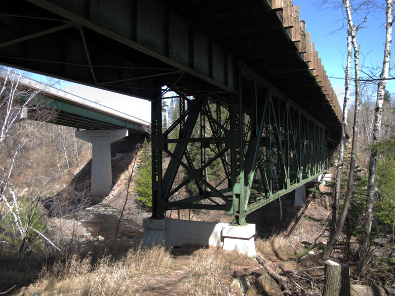
The old and new Baptism River Bridges, side by side.
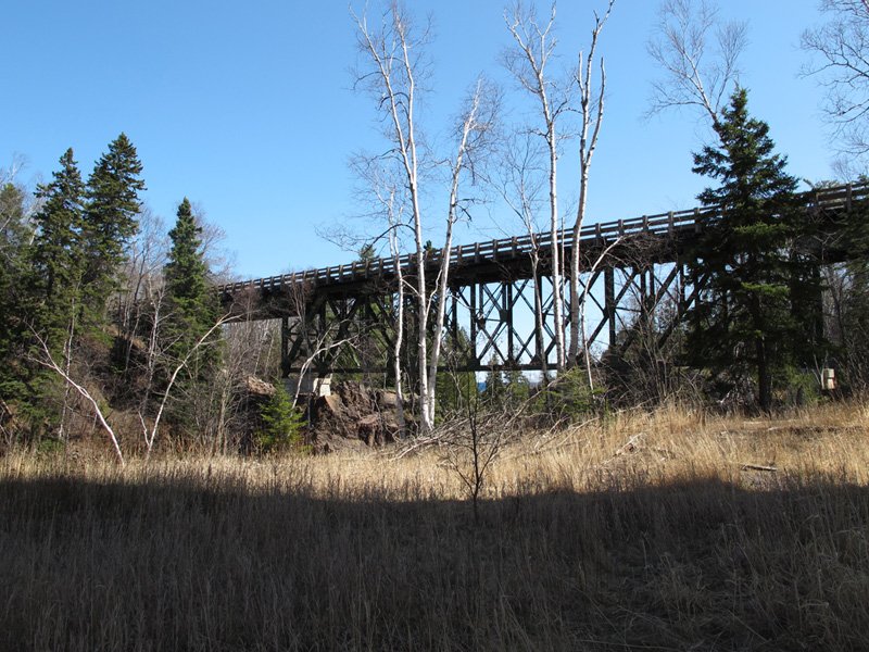
Profile view of the Old Baptism River Bridge.

Old bridge with rapids beneath.

One of the imposing piers of the current Baptism River Bridge.
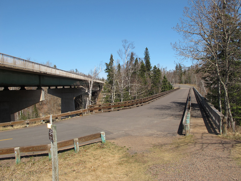
The old highway across the Baptism River, looking northbound. As narrow as the road is on the old bridge, it was actually NARROWER when the bridge was still in use as U.S. 61! The pedestrian walk is an extension of the original deck, added by the DNR in the mid 1980's. The wooden railings on either side also date to this time.

Looking north on the old highway as it approaches the main rest area building. The highway's path originally took it straight ahead through the mound of dirt at the traffic circle, and then behind the building towards the garage visible in the distance. In fact, the plans for the construction of the rest area in the 1980's show that a slice of the old asphalt pavement was to be used as the service driveway behind the rest area building.
However, it appears that this area has since been enlarged, and the old road lost.
Sources
- MNDOT. Construction Project Log: Control Section 3807
- Minnesota Highway Department. Construction Plan for Bridge 3459, 1922.
- Minnesota Highway Department. Construction Plan for Trunk Hwy No. 61-1 Between Little Marais and Two Harbors: S.P. 61=1-01, June, 1923.
- Minnesota Highway Department. Construction Plan for Roadside Development: S.P. 3807-06, 1948.
- Minnesota Highway Department. Construction Plan for Trunk Hwy 61, S.P. 3807-23. 1967.
- Minnesota Highway Department. Construction Plan for Trunk Hwy 61, S.P. 3807-28. 1967.
- Minnesota Highway Department Plan. Construction Plan for Bridge 38007, 1968.
- MNDOT. Construction Plan for Baptism River Rest Area, S.P. 3807-40, 1985.
- Minnesota Department of Natural Resources. Plan for Rehabilitation of Bridge No. 3459 Over the Baptism River, 2004.
