
 Historic U.S. 61: Connections Between Arcade Street and Mounds Boulevard, St. Paul
Connections Between Arcade Street and Mounds Boulevard
Located In: City of St. Paul, Ramsey County.
Bypassed: 1931, 1934 (see map for details)
Length: 0.95 miles (total).
Also Marked As:
 1921-1934
 1921-1934
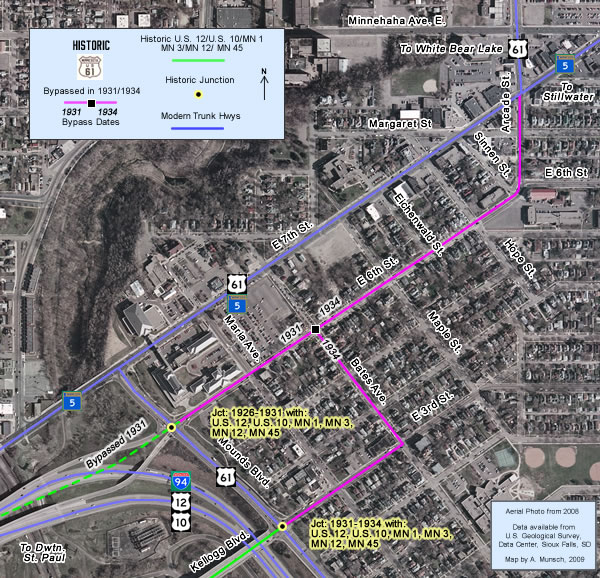
U.S. 61's route through the east side of St. Paul has always included parts of Arcade Street and Mounds Boulevard. However, the route between the two streets changed twice in the 1930's before the final route on East 7th Street was chosen. The original connection was along 6th Street, used from 1926 until 1931. The second route bypassed two blocks of 6th and two blocks of Mounds Boulevard via a jog on Bates Avenue and 3rd Street. The final route on 7th Street, chosen in 1934, has remained constant for 75 years.
Construction
Both connections were most likely already paved as city streets when U.S. 61 was first marked in 1926.
Bypass History / Historic Junctions With: 


The routing used by U.S. 61 on St. Paul's east side was linked to the junction of Mounds Boulevard with the main route across the rail yards in the old Trout Brook valley towards downtown St. Paul, marked as a concurrence of 6 routes between 1926 and 1934, including U.S. 10, U.S. 12, and Constitutional Routes 1, 3, 12, and 45. The junction was also the point where the baton was passed between Constitutional Routes 1 and 3, U.S. 61's predecessors. The original route into downtown was via the 6th Street viaduct, long since replaced by Interstate 94. The use of 6th Street was natural, as Arcade Street curved onto 6th Street at its south end.
Then in 1931, the new Kellogg Boulevard Viaduct was completed. The old 3rd Street viaduct that it replaced had terminated further to the west down the steep hill below the Dayton's Bluff neighborhood, making no connection with Mounds Boulevard. In fact, 3rd Street's grade was such that Mounds Boulevard passed over it via a bridge. The new viaduct fixed these issues, creating another connection between Mounds Boulevard and downtown to supplement those already existing on 6th and 7th Streets. MnDOH subsequently moved the main route into downtown south three blocks to the new bridge. U.S. 61's route was changed to use an odd jog via 3rd Street and Bates Avenue to reach 6th Street. Where U.S. 61's old route had required only one turn, the new route required two.
Finally in 1934 the Minnesota Department of Highways officially took over the right-of-ways of the trunk highways passing through the city limits of St. Paul. MnDOH finalized U.S. 61's route, using East 7th Street between Mounds Boulevard and Arcade Street.
Current Status
The various city streets used by U.S. 61 are intact and open, although they have since been repaved. Parts of 6th Street were reconstructed in 2009.
Photo Tour - Photos were taken in May, 2007.
Part 1- Arcade and 6th Streets

Looking south down Arcade Street at East 7th. Before 1934, U.S. 61 continued
south through the intersection instead of turning right (note the route markers
on the right.) This is now the north junction with State Highway 5. Highway 5 from St. Paul to Stillwater was originally marked as Constitutional Route 45. Route 45 followed U.S. 61 from this intersection to Mounds Boulevard, from where it continued into downtown. Route 45 was retired in 1934.

Looking back to the north on Arcade Street from Margaret Street towards East
7th. Note the 3M water tower.
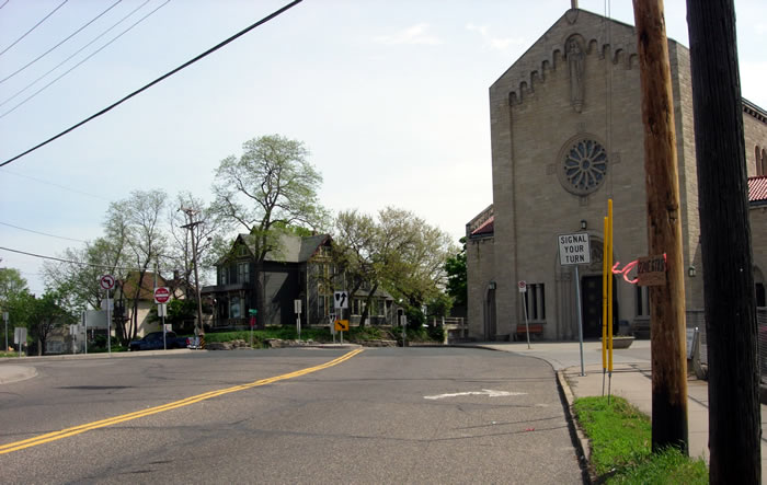
Looking northeast on 6th Street, where it curves onto Arcade, a remnant of
U.S. 61's old route. Note the sign asking motorists to "SIGNAL YOUR TURN".

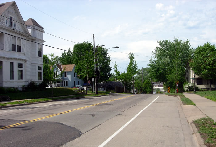
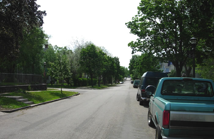
Looking southwest down 6th Street towards Hope Street, a former streetcar
line.

Looking back to the northeast down 6th between Hope and Eichenwald Streets.

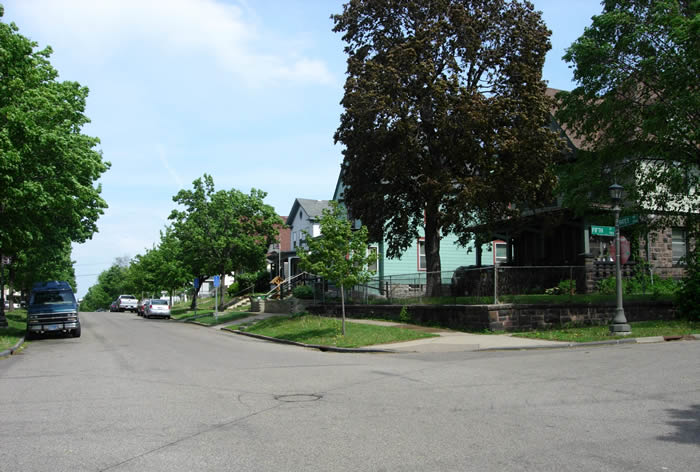
Looking southwest on 6th Street at Maple. 6th Street is lined with many impressive
victorian homes.
Looking southwest on 6th Street at Bates Avenue. U.S. 61 originally continued
down 6th towards Mounds Boulevard. U.S. 61 southbound would have made a left
turn here onto Bates from 1931 to 1934.

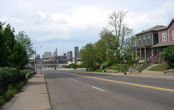
Looking southwest on 6th towards Maria. Note the old commercial building on
the left, a remnant of when Maria was one of the main streetcar lines on St.
Paul's east side. It is now occupied by "The Strip Club" (a steak house). Downtown St. Paul is visible in the distance.
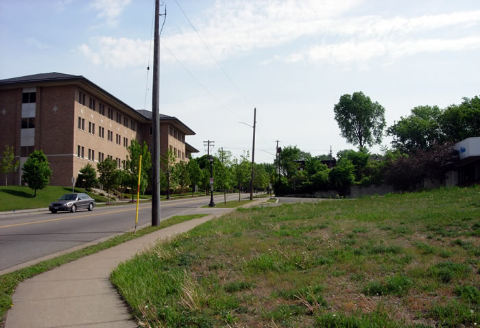
Looking back to the northeast down 6th from Mounds Boulevard. The large building
on the left is part of Metro State University.
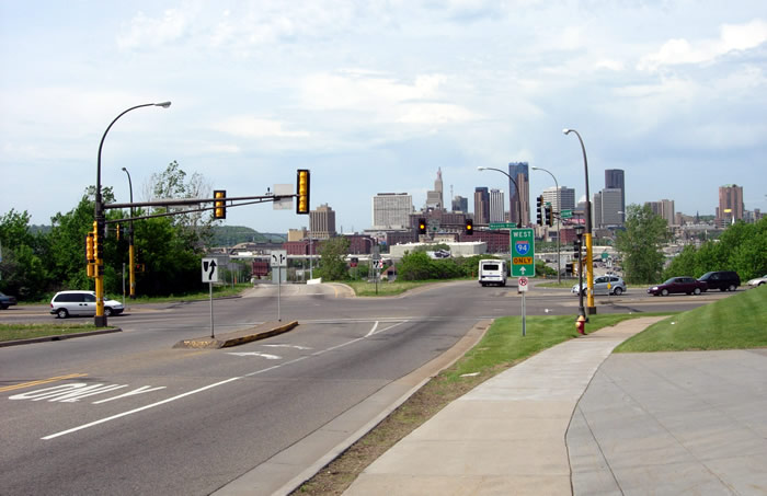
Looking southwest on 6th Street at the intersection with Mounds Boulevard
(modern U.S. 61). The ramps to and from Interstate 94 are just ahead. They
were originally built back in 1966. The ramps were constructed on the site
of the old 6th Street viaduct, once the main trunk route into downtown St.
Paul. Southbound U.S. 61 would have made a left turn here onto Mounds Boulevard.

Another view of the intersection of 6th and Mounds Boulevard, looking north.
U.S. 61 would have made a hard-right turn here from 1926 until 1931. The impressive
edifice of Metro State University's New Main is on the right. It was constructed
on the site of St. John's Hospital.
3rd Street and Bates Avenue

Looking north on Mounds Boulevard (modern U.S. 61) towards the intersection
with 3rd Street and Kellogg Boulevard. Between 1931 and 1934 U.S. 61 made
a hard right turn here onto third instead of continuing ahead on Mounds Boulevard
(note the overhead signs).
Looking back to the southwest down 3rd Street towards Mounds Boulevard and
the Kellogg Boulevard viaduct into downtown St. Paul. The intersection was a trunk highway junction from
1931 until 1980 (Kellogg carried U.S. 10 and 12 into downtown until the early 1950's, after which it became part of Highway 5). The current viaduct to downtown was constructed in 1983.

Looking northeast down 3rd Street towards Maria after turning off of Mounds
Boulevard.

Looking northeast on Third Street at Bates Avenue. U.S. 61 would have made
a hard left turn here onto Bates towards 6th.

Looking north on Bates at 4th Street. Bates is a rather narrow, which makes
me wonder why it was chosen to be part of U.S. 61's route.
Looking north at Bates and 5th Street.
Looking back to the south down Bates Avenue from 6th Street.