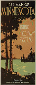
Reverse Side Not Available

|

Stats:
- Size: 38" x 32" unfolded, 4"
x 9" folded.
- Scale: 1 inch = 12 miles
- Conditions as of: May 1, 1934
- Commissioner of Highways: N. W. Elsberg
- Cartographer: McGill - Warner Co, St. Paul
Comments:
- First map with a cover when folded.
- First map to show Minnesota's expanded trunk highway system, authorized in 1933 and taken over in 1934.
- The background color of the state has been changed to a dull yellow, a feature that will persist until 1940.
- The back of the map has been updated with more information for tourists and the first photographs seen on an official Minnesota highway map.
- A new format of Twin Cities inset was introduced, used through 1940.
|