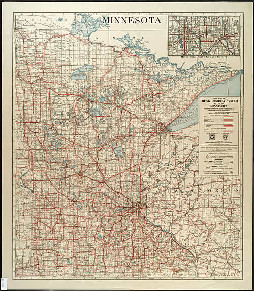
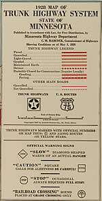
1928 Map of Trunk Highway System, State of Minnesota
Era 1: The McGill-Warner "Red" Maps, 1923-1932
Previous Year (1927) << 1928 >> Next Year (1929) |
Stats:
Comments:
|

Previous Year (1927) << 1928 >> Next Year (1929) |
Stats:
Comments:
|
![]()
All content © Andrew Munsch