Home >> Projects >> U.S. 61 >> Modern Highway Photo Galleries
 Modern Highway Photos: Hastings and the Junction with Highways 50 and 20
November, 2005
The following photos were taken on a clear fall day as I drove on roads adjacent to U.S. 61 near Hastings.

Driving east on County Road 42 into Hastings in mid-afternoon. The Hastings
High Bridge, which carries U.S. 61 over the Mississippi River, is visible
through the trees on the left. The overpass over 2nd/Main Street is also just
visible in the distance. County Road 42 is the original alignment of what
eventually became State Highway 55. It was first marked as State Highway 53
from 1921 until 1931, when it was moved south to the current alignment. Highway
53 at Hastings was renumbered to 55 in 1934.

Entering downtown Hastings, looking east on County Road 42. Note the historic
houses on the right (including the octagon house). The 2nd/Main St. overpass
is just ahead.

Another view, a little further east.

Looking north under the south end of the Hastings High Bridge on 2nd/Main
Street, former site of the junction of U.S. 61 with State Highway 53 (now
the eastern terminus of County Road 42). The bridge was completed in 1951.
It is scheduled for replacement in 2010.

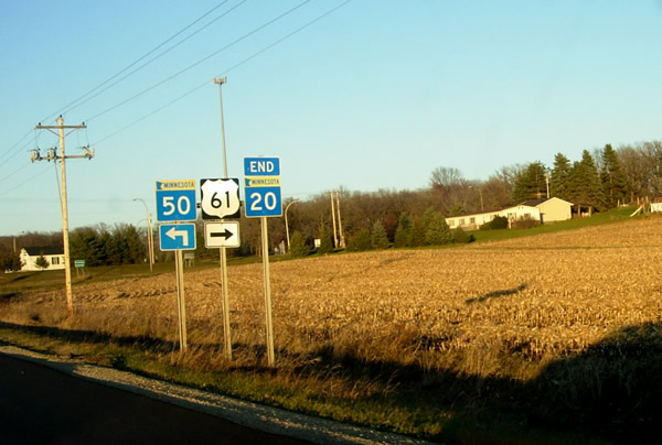
On State Highway 20 a bit later in the day towards sunset, looking north towards
its northern terminus at State Highway 50. Note the sign indicating a junction
with U.S. 61. Hwy. 20 no longer technically has a junction with U.S. 61, instead
using a short jog to the east on Hwy. 50. Highway 20 once continued north
through the junction to meet U.S. 61 at a shallow angle. A project in 1984
rebuilt the junction to its current configuration.

More signage at the northern terminus of State Highway 20.
