
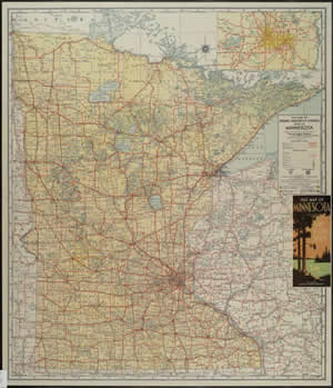
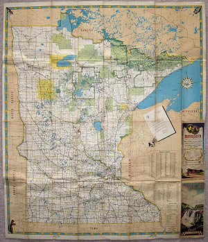
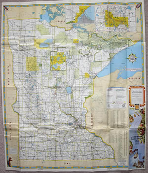
The Evolution of the Minnesota Official Highway Map
The Minnesota Department of Highways and later MnDOT have been required to print an official highway map "for free distribution" since the earliest days of the trunk highway system. Many of these maps (especially the early ones) are beautifully colored and detailed, with pictures and other features to aid in their role of facilitating the tourist trade within the state. Naturally, the maps are also useful historic documents, chronicling the development of Minnesota's highway system.
The maps themselves have gone through a distinct evolution that can be broken into several "eras", each with its own distinct format, size, and overall appearance.
Note: This article only examines the maps issued from 1923 on, excluding most variants and other condition maps. Maps issued before 1923 were not useable as navigation aids for motorists, and were instead used to show the state of Minnesota's highway network.
Contents:
Size and Frequency of Issue
Before we explain each era individually, a few overall factors need to be examined.
A comparison of the three unfolded size formats of the official
highway map. The maps have been lined up at their lower-right corners.
Note how the modern map lines up with the height of the original, and the
width of the "mini".
A comparison of the folded size of the official maps, with the oldest on the
left, and the newest on the right.
Size
Unfolded
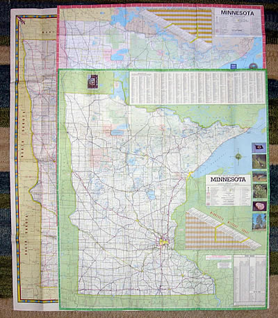
Surprisingly, Minnesota's official maps have had only three standard unfolded sizes (see image, right, for a comparison).
- The original, largest, and longest running size was about 38 x 32 inches, used from 1923 to 1966. The actual size of the maps fluctuated slightly, especially in the early years, but 38 x 32 seems to have been the standard.
- The second size, the smallest used, was 30 x 26 inches, used from 1967 to 1983 (I usually refer to these as the "mini-maps").
- The third size, in use since 1987, is 38 x 26 inches, a compromise of the dimensions of the original standard size and the "mini-maps", allowing more information to be displayed while keeping the map at a manageable width for use in the car (the 1985/86 map used a non-standard size, slightly shorter at 37 inches).
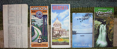
Folded
The official maps have had five standard folded sizes over the years.
- The maps issued from 1923 to 1933 did not have a cover when folded, usually coming in at about 5.5 x 9.75 inches.
- The maps issued from 1934 to 1940 were the first with covers, measuring about 4 x 9 inches.
- The maps issued from 1940 to 1966 used a standardized size of 4 x 9.5 inches, slightly taller than the earlier maps.
- The "mini-maps" issued from 1967 to 1983 measured about 4.5 x 7.5 inches, slightly wider when folded then the previous generation, but much shorter.
- The modern maps, issued from 1987 to present, measure about 4.25 x 8.75 inches (the 1985/86 map was unique, measuring about 4 x 8.75 inches).
Frequency of Issue
A new map was issued every year between 1923 and 1942, and again from 1946 to 1976. During World War 2, the 1942 map was reissued with a sticker on the cover showing the current year. MnDOH apparently also issued an "early edition" map during the 1930's.
When the Department of Highways was absorbed into MnDOT in 1976, the frequency of issue was changed to every two years. An earlier attempt at bi-annual issue had been made in 1968, when the map issued displayed the legend "1968-1969 Official Highway Map". However, a new map with the same format was issued the next year with "1969" displayed instead.
Official Map "Eras"
There have been seven distinct "eras" of official map format, summarized as follows:
- Era 1: 1923-1932 - The McGill-Warner "Red" Maps
- Era 2: 1933-1940 - The McGill-Warner "Yellow" Maps
- Era 3: 1940-1950 - The Department Of Highways "Black and White" Maps
- Era 4: 1951-1961 - The Gousha Maps
- Era 5: 1962-1966 - The Modern "Large Size" Maps
- Era 6: 1967-1983/84 - The "Mini-Maps"
- Era 7: 1985/86-Present - The "Explore Minnesota" Maps
Era 1: The McGill-Warner "Red" Maps (1923-1932)
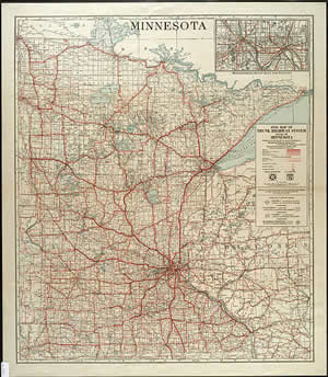
The 1931 official highway map, typical of the maps
issued from 1923 to 1932.
The first era of official maps coincided with the existence of the constitutional routes, Minnesota's first trunk highway network. Cartography and printing were provided by the McGill-Warner Company of St. Paul, who continued to produce official maps for the Department of Highways until 1940. The era 1 maps were characterized by a lack of a cover when folded, and an absence of extraneous information and imagery.
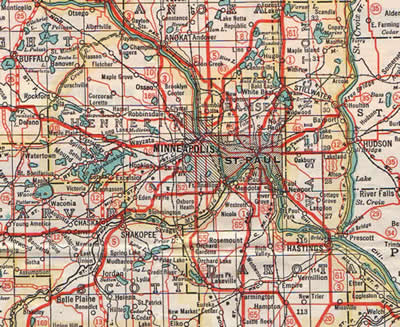
The basic format of the map barely changed between 1923 and 1932 (see the image of the 1931 official highway map, right). The only inset provided was of the Twin Cities, positioned in the upper right corner. Nearly half of the state of Wisconsin was also shown, with the map key hugging the right side.
The original cartography was crude and drab, printed in only red, blue and black inks. Thick red lines representing the trunk highways were printed over a standard map of Minnesota showing towns, railroads, bodies of water, and the township and range system (see close-up of the 1931 map below). Printing was limited to the front of the map until 1932, when two sided printing was introduced. The information on the back was limited to a city-to-city mileage finder, plus mileage tables for each trunk route.

Era 2: The McGill-Warner "Yellow" Maps (1933-1940)
"Era 2" Map Evolution
1933 map with no cover and white state background.
1934 map, with cover and yellow state background,
plus new Twin Cities inset.

Back of the 1938 map, with typical tourist info. Also
note the "Marvelous Minnesota" slogan.

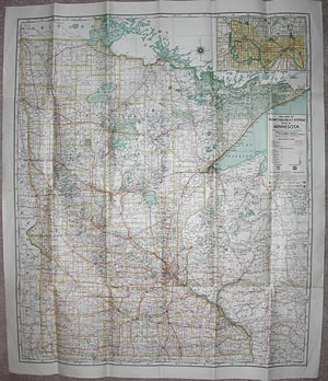
1939 map, with later folding pattern and Duluth inset.
The 1933 Map
The 1933 official map introduced the first major update to the cartography. The printing of the lines representing roads was made finer and easier to read (the red color and paving symbols remained the same, see image, below). The fonts used were modernized throughout. Green and yellow tints were added, making the map more colorful. Despite these change , the 1933 map retained the folding pattern and overall layout of the previous era's "red" maps.
A close up of the updated cartography introduced on the 1933 map.
1934 and Beyond
1933 happened to be a year of major change for Minnesota's trunk highway system. The legislature added a huge number of new trunk routes to the books, which led to a renumbering of the entire system in 1934. As part of this expansion, the Department of Highways also heavily updated the format of the official highway map. The redesign was aimed at making the official map a vehicle for promoting tourism in the state. A press release from 1934 stated the following:
"Making an innovation in official Minnesota road maps, the large size maps of the state highway department this year for the first first time are designed definitely to advertise the state's scenic and vacation attractions and draw tourist business. Each year, the highway department sends hundreds of its maps to tourist information centers in every state in the union, Mr. Elsberg [commissioner of highways] said. At an exceedingly small cost, we found it possible to add life and interest and tourist appeal to the map this year. We believe the change will aid greatly in advertising Minnesota."
To accomplish this goal, a colorful and artistic cover was added for the first time. In addition, the map now folded to a new compact size. Numerous photos promoting tourism were added to the back of the map, along with several new information tables (see images, right). These replaced the old mileage tables seen on the 1932 and 1933 maps.
Design wise, the new cartography introduced in 1933 was retained. The most obvious change was the change to a dull yellow for the background, a feature that would be retained on the rest of the "yellow" era maps (hence the name). A new format of Twin Cities inset showing an expanded area was also introduced.
Close-up of the 1939 official map, showing the cartography used from 1934 until the 1940 advance edition (mileages between junctions were added in 1939). Note how the township and range system is just barely visible as white lines within the yellow background.
Changes to the "yellow" era maps issued through the remainder of the 1930's were few. The folding pattern was changed in 1937, and a Duluth inset was added for the first time in 1939.
Era 3: The Department of Highways "Black and White" Maps, 1940-1950
"Era 3" Map Evolution

1940 map with new format, no back cover.

1941 map with back cover, new decorative border and
corner images.
1948 map with map key moved to back cover and
Twin Cities/Duluth insets moved to reverse side.
1949 map with key moved off of back cover, Twin Cities
and Duluth insets on the front of the map.

1950 map with stylized key, Twin Cities and Duluth
insets moved to reverse side again.
In 1940, the Department of Highways dropped McGill Warner as the cartographer of the official highway maps, and introduced a totally new cartography and format. The new maps used black lines on a generally white background (hence "Black and White" maps). These maps were a definite improvement over the old "yellow" maps - they were clearer and easier to read, and had a much cleaner, uncluttered look.
The 1940 Map
The first of these maps, issued in 1940, had a few unique quirks in comparison to its later cousins (see close-up, below), mostly in the coloration of map features. Blue was used for both secondary roads and the shading of incorporated areas; red and yellow were used for the county borders and names. It was the last official map (and only "black and white" era map) to feature the township and range system, represented by thin blue lines.
Close up of the 1940 map's cartography.
On the 1940 map, llines representing trunk highways mysteriously disappeared in the corporate limits of cities. It was probably assumed that motorists only needed to know which road went to each town, and that signs would serve to guide them the rest of the way. However, this made the trunk lines a bit harder to follow across the map. Later maps were modified to show very thin lines within the city limits, allowing motorists to visualize the connections made in-town.
One of the most interesting features of the 1940 map was its legend (see image, below). Instead of the standard list of features and symbols usually seen on highway maps, the 1940 map used the symbols in a hypothetical context. As far as I know, this is the only official map issued to do this.
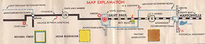
The unique 1940 "map explanation".
The 1940 map also introduced a new format for the Twin Cities and Duluth insets, designed to match the format of the main map. These insets were used until 1948.
The 1941 Map
Although the 1940 map was the prototype, the map issued in 1941 ended up as the basic template for the maps issued through 1950 (see below). Note the changed colors (gray corporate limits, brown secondary roads, yellow county lines and names), absence of the township and range system, and thin lines within the corporate limits of cities. The 1941 map was also the first to have a back cover and color photos on the reverse side.
Close-up of the 1941 map's cartography.
A common feature of the maps issued between 1941 and 1950 was a decorative border featuring images in three of the corners. At the top corners were a marquis symbol and an arrowhead, representing Minnesota's original inhabitants (french fur traders and native americans respectively). The lower left corner featured a gopher with a football, celebrating the 1940 national champion Gopher football team.
1948 and Beyond
The next change that modified the appearance of the map occurred in 1948, when state forests, shaded in green, were added (see image, right). This gave the later "black and white" era maps a more filled-in look.
The last of the "era 3" maps, issued in 1950, featured several major changes to the map's color pallet (see close-up below). The background colors were reversed, making Minnesota darker than the surrounding states and provinces. U.S. routes were also colored red to make them stand out.
Close-up of the 1950 map's cartography.
The Reverse Side
The reverse side of the official maps also went through quite a few changes during the 1940's. The 1940 map featured a redesigned spread of black and white photos, similar in concept to the maps issued in the 1930's. In 1941, these images became color for the first time. The striking color image mosaic introduced in 1941 was only used for two years. In 1946, when printing of the official maps resumed after World War 2, these images were replaced by insets of cities with populations over 10,000. The format of the new insets was later adopted for use on the Twin Cities and Duluth insets, starting in 1948.


Above, a comparison of the most common formats of the reverse side of the "era 3" maps. From left to right: the 1940 map with black and white photos, the 1941 map with color photo mosaic (also used in 1942), the 1946 map with city insets and regional map (also used in 1947), and the 1948 map with the new Twin Cities and Duluth insets (modified and used again in 1950), with city insets and "Keep Minnesota Green" art. The 1949 map (not pictured) had a feature on Minnesota's territorial roads.
Era 4: The Gousha Maps, 1951-1961
"Era 4" Map Evolution

1951 map with filled in state/national forests, lack of
color.
The back of the 1951 map, with old-style city insets.
1952 map with alternate folding pattern, and
finalized cartography.
Back of the 1952 map, with alternate folding pattern
and color photos.
1953 map, with finalized front-side layout.

Back of the 1953 map, showing the standardized
layout used until 1958. Note the tight grid of insets
arranged around a national highway map, plus the
large mileage finder.

Back of the 1959 map, showing the revised standard
layout used from 1959 to 1961.
In 1951, the Department of Highways contracted with the H.M. Gousha company to produce the cartography for the official highway maps. The Gousha Company (pronounced Goo-Shay) was known at the time as one of the premier road map producers (see the wikipedia article here). The maps produced by Gousha between 1951 and 1961 were probably the finest official maps ever issued by the Department of Highways, although they sometimes lacked the rustic charm of the maps produced in the 1930's and 1940's.
The 1951 Map
For the most part, Gousha kept the old cartographic symbols and format. The main visible change to the cartography was in the sharpness of the features and lithography (see the close-up of the 1951 map below). Note the finer, more precise lines representing roads, plus the improved positioning of map labels, resulting in a map that is less cluttered, and therefore much easier to read, if not a little colorless. The one symbol change was for parks and roadside parking areas, now represented by small trees, rather than by squares. The 1951 map had a definite lack of color due to the lack of yellow tints on the main map. State and National forests were fully colored in.
Close-up of the 1951 map's cartography, showing the lack of yellow tints.
Gousha also introduced a new format for the Twin Cities and Duluth insets in 1951. For some strange reason, all highways on the 1951 insets were colored red. The old style city insets on the reverse side of the map were also temporarily retained. The french symbol and arrowhead in the upper corners of the map remained from the previous map design. The blue and yellow borders were modified into a diamond design. The map key was permanently positioned in the upper-right corner. It continued to get more and more ornate between 1951 and 1961.
The 1952 Map
Gousha finalized the "era 4" cartography (for the most part) on the 1952 map. Yellow tints were added, and symbols for divided highways were added for the first time (see image below). State and national forests were no longer fully filled, and instead had thick green borders. The Twin Cities and Duluth insets were also updated to match the main map. The cartography introduced in 1952 essentially remained unchanged through 1961.
Close-up of the 1952 map, showing the addition of yellow tints and the addition of symbols for divided highways.
The Department of Highways experimented with a new folding pattern in 1952; the map opened like a book instead of opening vertically. When unfolded, the map cover was on the back of the map, rather than on the front (see images, right). The back of the 1952 map also featured color photographs, the first since 1942. Color photos would be a nearly constant feature on the reverse side of the Gousha Era maps.
1953 and Beyond
The 1953 map was the first to fully incorporate Gousha cartography, both front and back. Gousha created a new format for the city insets and also provided a national highway map. After 1953, the maps became very standardized. The reverse side also tended to have a standard format from year to year, with the exception of 1958, when the back of the map was taken over by a feature on Minnesota's roads in 1858 as part of the statehood centennial celebration. 1959 introduced a new reverse side format, seen until 1961 (see images in the evolution side-bar, right).

Close-up of the Gousha era city insets, introduced in 1953.
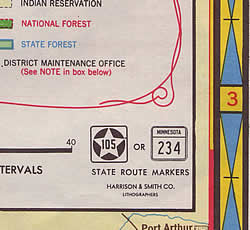
Minnesota finally retired its old format route markers (a black star on a white background) in the early 1950's, replacing them with modern square marker. To reflect this change, Gousha changed the round route symbols on the map to square. These were a little messy when first introduced in 1956.
A close-up of the 1954 map's key, showing the transition in the route marker format.
Close-up of the 1956 map's cartography, showing the sloppy square route markers.
In 1959, Interstate Highways were shown on the map for the first time. At first, Gousha displayed them using the same symbol as U.S. divided highways. An independent symbol wasn't introduced until 1961.

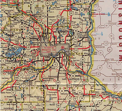
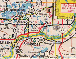
Close-up of the 1961 official highway map, showing the completed section of I-35 near Owatonna.
In 1961, the Gousha Company was purchased by Time Mirror, and probably not coincidentally, the Highway Department retook its control over map production in 1962.