
Lost Highway: County Road 81, Dakota County
Bypassed: 1947
Marked As:  and
and  1934 -1947
History
The original alignment of US Highway 52 between the towns of Hampton and Coates was along the roads now marked as County Road 81, including Darson Avenue, 210th Street, and Clayton Avenue. The original route was bypassed in 1947 upon the construction of a more direct road, now the southbound lane of the modern divided highway. US Highway 52's route was first extended into Minnesota as part of the system overhaul of 1934. It replaced most of what had previously been US Highway 55, the old primary route between Rochester and the Twin Cities. The big difference was that US 52 was routed to St. Paul instead of to Minneapolis as US 55 had been. US 52 replaced US 55 and State Highway 50 on the concrete road completed in 1928 from Cannon Falls to just northwest of Hampton, where instead of continuing west to Farmington as US 55 and HIghway 50 had, US 52 veered onto the old short-cut to St. Paul via Pine Bend. The road to Pine Bend was still gravel when it was added to the trunk system in 1934. State Highway 56's route was also extended north from Hampton to Pine Bend, duplexed with US 52. The road from Hampton to Pine Bend remained gravel until it was bituminous surfaced in 1938, making it the last section of US 52's route between Rochester and St. Paul to be paved (the junction with Highway 50 was also modified at the time). The paving of the route was in reality only a stop-gap measure until a more direct alignment could be constructed. The new highway constructed in 1947 was much more direct; it bypassed two right-angle turns on the old route, as well as the center of Hampton. With Hampton bypassed, State Highway 50 retook its old route through town to maintain connections with the new alignments of US 52 and State Highway 56 on the southeast side of town. The new alignment also bypassed an at-grade rail crossing on the south side of Coates (the tracks have since been removed). Highway plans show that the old alignment on Clayton Avenue, 210th Street, and Darson Avenue was designated County Road 34 after being turned back to Dakota County. It was eventually renumbered as County Road 81. The old road has barely changed since being bypassed in 1947, though the original bridges have been replaced, and the road resurfaced. The biggest disruption to the old route has been at the intersection with modern US 52 at Coates. The northern end of County Road 81 was recently realigned to make way for the County Road 46 interchange, completed in 2004.
|
Data available from U.S. Geological Survey, EROS Data Center, Sioux Falls, SD |

Photos
Part 1: Highway 50 through Hampton to County Road 81
Photos taken in May, 2007 unless otherwise stated. Ordered roughly from south to north.

Looking north on modern US 52 at the interchange with State Highway 50 at
Hampton. This has been the site of a trunk highway junction since the realignment
of US 52 in 1947. Before 1947, the old concrete highway used by US 52 curved
rather sharply to the left (west) just ahead onto what is now State Highway
50 through Hampton (see diagram below). Photo from November, 2006
 |
Left, an aerial view of the modern junction of US 52 with State Highways 50 and 56. Note the path of the old concrete highway, which featured a pair of sharp curves designed to force the highway to meet the railroad south of Hampton at a 90 degree angle. This type of design seemed to be popular with highway planners in the 1920s. It appears again at the junction of State Highways 3 and 149 in Inver Grove Heights. In both cases, one of the curves has been eliminated by further construction. |

Looking west on Highway 50, just west of the junction with US 52. Just ahead
is the site of the old railroad underpass. The bridge over the highway has
since been removed. Highway 50 still uses the same grade that US 52 used before
1947, although the old concrete pavement from 1928 has long since been paved
over. (Photo from February, 2006)

The road curves sharply again towards Hampton just west of the old underpass.

Entering Hampton.

At the junction with County Road 47 in Hampton, looking northwest. This was
the original junction of US 52 with State Highway 56 from 1934 until 1947.
Highway 56 approached from the left (south), and then duplexed with US 52
the rest of the way to Pine Bend, where it split onto Concord Boulevard to
South St. Paul. back to top
Part 2: County Road 81
Photos from April, 2006 unless stated otherwise. Ordered roughly from south to north.
Junction of State Highway 50 and County Road 81
The junction of State Highway 50 with County Road 81 was once the junction of US 52 / State Highway 56 with State Highway 50. It was also an important turn-off for motorists heading for St. Paul. The junction's configuration dates back to 1938, when it was reconstructed to lessen the severity of the curve on the main highway.
Approaching the turn-off onto County Road 81 from Highway 50 westbound.

Looking northwest at the junction. Highway 50 is on the left, the connecting
drive to County Road 81 on the right. (Photo from November, 2005)

A different view, this time from Highway 50 eastbound. back
to top
On County Road 81
Following: views of County Road 81, northbound


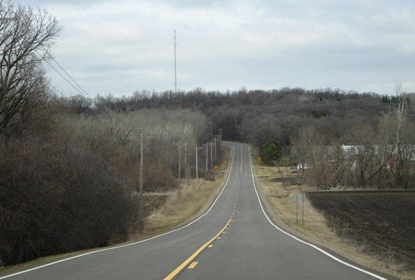
One of the two ninety degree angle turns, looking west on 210th Street before
the turn onto Clayton Avenue.

Looking north on Clayton Avenue.


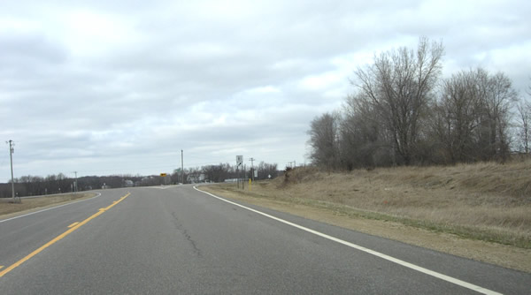
Looking back to the south down County Road 81 (Clatyon Ave), just south of
Coates.
North junction of County Road 81 with US 52 at Coates
|
The junction of County Road 81 with US 52 at Coates has been reconfigured several times since 1947(see diagram, left). The original junction was closed and moved south when US 52 was upgraded to four lanes in 1962. The junction constructed in 1962 remained in use until 2002, when County Road 46 was constructed around the south side of Coates. The new junction of County Road 46 with US 52 quickly proved to be a massive planning blunder. Soon after completion, accidents started to occur at an alarming rate, including several resulting in fatalities. As a temporary measure, MNDOT disallowed all left turns until a stoplight could be added at the intersection. The stoplight naturally caused traffic problems on busy US 52. An interchange was completed in 2004 to eliminate the problem once and for all. Sources: MNDOT Newsline, August 21, 2002, No. 74. http://www.newsline.dot.state.mn.us/archive/02/aug/21.html MNDOT Newsline, November 3, 2004, No. 138. http://www.newsline.dot.state.mn.us/archive/04/nov/3.html |

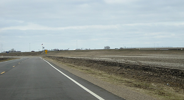
The northern end of County Road 81 now curves to the west to a new junction
with County Road 46. The interchange of US 52 with County Road 46 is visible
on the far right.