
Old Sibley Memorial Highway - Mendota Heights
Bypassed: 1993
Marked As: 

 1934-1993
History
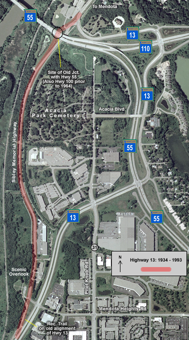
In 1993 the Mendota Bridge was rehabilitated and the highways leading from it into northern Dakota County were reconstructed to improve one of the important connections between the growing southeast suburbs and Minneapolis. Highway 55 was fully upgraded to four lanes between the bridge and Mendota Heights Road, and a modern interchange was constructed between Highway 55 and 110. The junction of Highway 13 with Highway 55 at the east end of the bridge was removed, allowing traffic on the span to maintain freeway speeds and improve traffic flow. Because of this change, Highway 13 had to be realigned onto a series of new roads to maintain connections with both Highway 55 and Highway 110. North of 494, Highway 13 was upgraded to four lanes and curved eastward into new intersections with Pilot Knob Road and Highway 55. Service drives were constructed north from the new junction with HIghway 55 to carry Highway 13 to Highway 110, and to then reconnect with the old alignment into Mendota. Portions of the service drives were constructed on the previous alignments of Highways 55 and 110. The original road, which had been in use by Highway 13 since 1934, was left intact except for its connections to the realigned HIghway 13 on both ends. On the south, the old road was rebuilt to connect to modern Highway 13 at the intersection with Mendota Heights Road. A bit of the old alignment south of the intersection became the alignment of a recreation trail. The north end of the old road was realigned to pass under the ramps leading off of the Mendota Bridge. Ironically, the old road is still the better route for through-traffic on Highway 13; it is not only shorter, but also avoids any junction with busy Highways 55 and 110. Until recently, the old alignment was still counted as part of the trunk highway system as unmarked route MN 913A. It has since been turned back. The old road runs along the feature known as "Pilot Knob", an old landmark for riverboat traffic, now home to Acacia Park Cemetery. A scenic overlook constructed in 1938 is also accessible from the old highway just north of Mendota Heights Road.
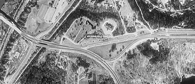
A comparison of the junctions of Highway 55 with Highways 13 and 110 from before (above) and after (below) the 1993 reconstruction. (Data available from U.S. Geological Survey, EROS Data Center, Sioux Falls, SD.)
|
|

Photos
(Photos taken March and November 2006, ordered roughly from south to north)
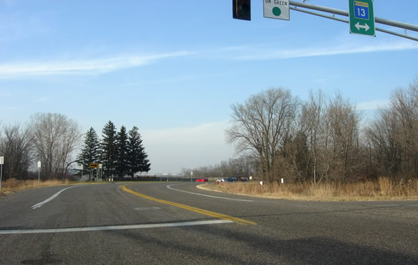
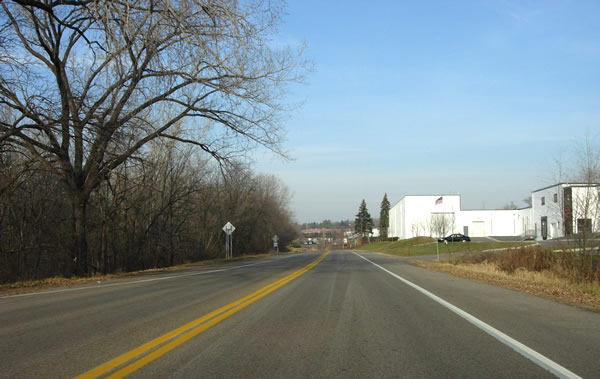
The entrance to the old alignment at Highway 13 and Mendota Heights Road,
looking northwest. The scenic overlook is visible ahead.
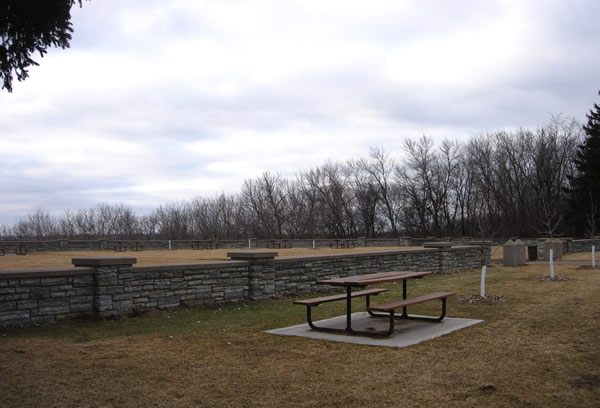
A closer look at the scenic overlook, built in 1938.
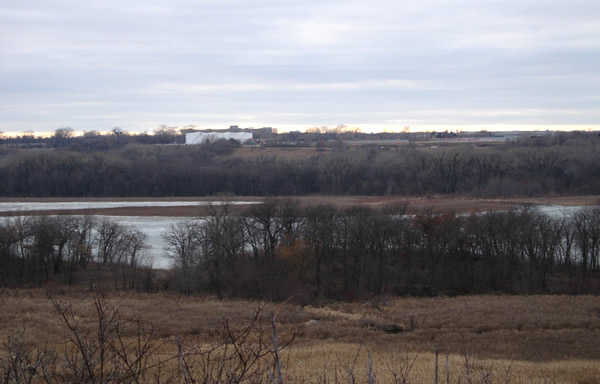
The view of the Minnesota River Valley from the scenic overlook. The valley
is now part of Snelling State Park. The overlook is directly below the flight
path of airplanes taking off and landing at the International Airport on the
other side of the river.
Following Photos: Sibley Memorial Highway, northbound
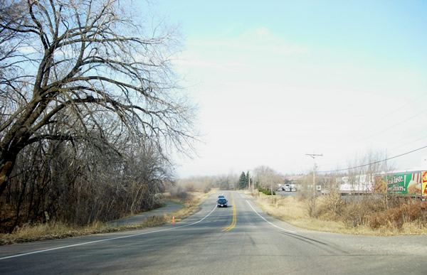
Old Highway 13 still serves a few food processing plants, including Lloyd's
Barbeque.
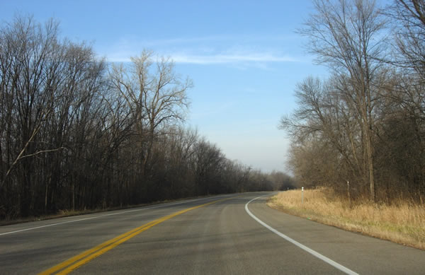
The old highway is paralleled by a recreation trail, constructed after the
1993 realignment.


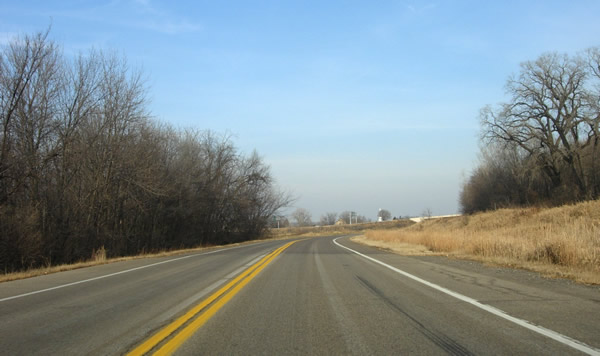
Approaching the Mendota Bridge from the south. Note the change in pavement
ahead, marking the beginning of the 1993 reconstruction. The Highway 55 overpass
and the steeple of St. Peter's church are just visible.
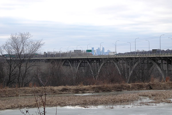
The view of the Mendota Bridge from the old alignment, with downtown Minneapolis
in the distance.
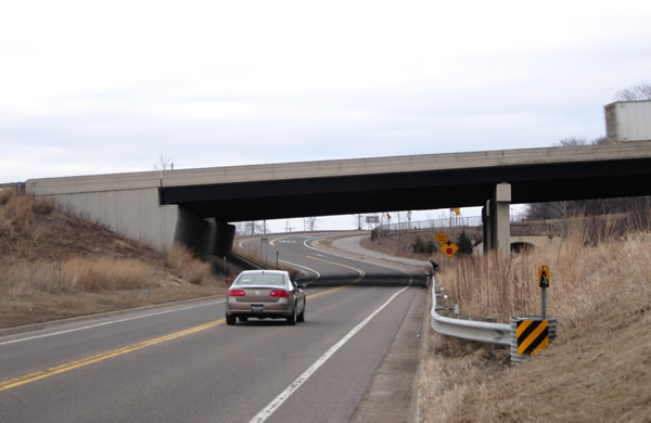
The new Highway 55 overpass, built as part of the 1993 reconstruction. The
old junction with Highway 55 was just to the left (west). Highway 13 also
met Highway 100 there from 1934 until 1964 (Highway 100 shared the Mendota
Bridge with Highway 55 before the construction of the 494/694 loop). Notice
the tunnel on the right for the recreational trail that parallels the old
highway. The intersection with the realigned Highway 13 is just ahead.
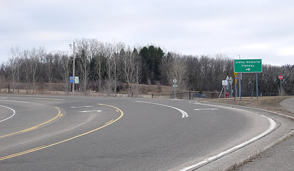
The north entrance to the old alignment, looking south. Notice how Highway
13 now curves sharply here towards the junction with Highway 110.