
 Lilac Park (Old St Louis Park Roadside Park)
Lilac Park (Old St Louis Park Roadside Park)
Originally Adjacent To: ![]()
![]()
Historic Context: Roadside park constructed by relief labor as part of the Highway 100 Beltline or "Lilac Way". Designed by A.R. Nichols.
Construction: ca. 1939, restored and rebuilt 2008-2009.
Historic Structures: All built in ca. 1939
- Beehive Fireplace (moved from old Lilac Park in 2008).
- Original Fireplace (lost)
- Council Ring (restored)
- 5 stone picnic tables and benches (one originally lost, all now restored).
- Trash Receptacle (lost?)
Last Visited: August 5, 2017
Lilac Park (formerly St Louis Park Roadside Park) is a beautifully restored remnant of the roadside parks that once dotted the length of Highway 100. Once known as either "Lilac Way", or "The Beltline", the highway was built in the mid-to-late 1930's on what was then the western edge of the Twin Cities Metro using relief labor as part of the work programs instituted during The Great Depression.
Highway 100 was functionally designed as part of a future urban bypass, but also as a showcase of "roadside beautification". The landscape surrounding the highway was given extensive plantings of lilacs and other flora. Numerous roadside parks designed by Highway Department landscape architect Arthur Nichols provided motorists with opportunities to pull over for a picnic. The roadside facilities, completed for the most part in 1939, were built in the "rustic" style which made extensive use of natural materials such as stone and wood. The parks usually featured at least stone picnic tables, and various kinds of fireplaces for cooking. The grander parks featured council rings and/or rock gardens.
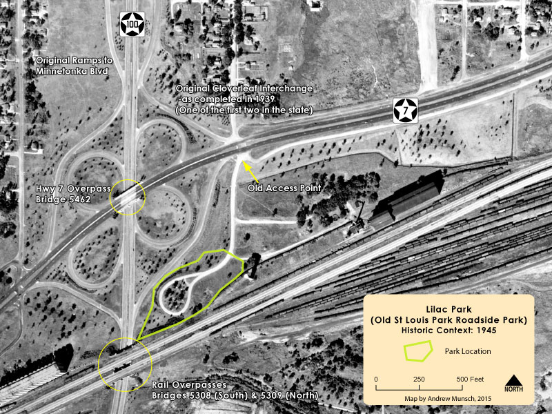 St Louis Park Roadside Park was built at the southeast corner of the cloverleaf interchange of Highways 100 and 7 (the interchange was one of the first of its kind in the state of Minnesota). Access to the park was originally provided by a driveway that connected directly with Highway 7 east of Highway 100. This drive ended in a circle that surrounded the picnic area. Note in the image above the original plantings of trees all around the interchange, as well as the large rail yard and grain silos south of the park site. There was already some residential development in the area, but not as dense as today.
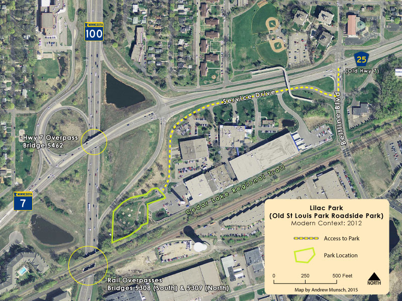 Today access to the park is provided via a service drive accessible from Beltline Boulevard off of County Road 25 (former Highway 7). The access road now ends just short of the park at a small parking lot, and the old drive around the park has been converted into a paved trail. The large rail yards south of the park have been replaced with an industrial park, and the site of the grain silos is now occupied by apartment buildings. One of the rails has been converted into the Cedar Lake Regional Trail. Also note how the nearby interchange has been reconfigured. The bridges visible in the above image are all original to the 1930's, but have since been demolished as part of the reconstruction of Highway 100 that started in 2015.
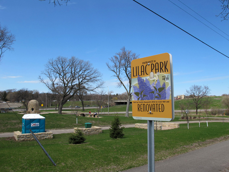
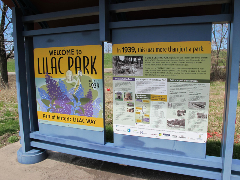 The restored park greets you with a very well done interpretive sign that does a great job explaining the significance of the roadside parks and the construction of the beltline.
 The highlight of the park is the restored beehive fireplace, moved here from the Old Lilac Park at Minnetonka Boulevard.
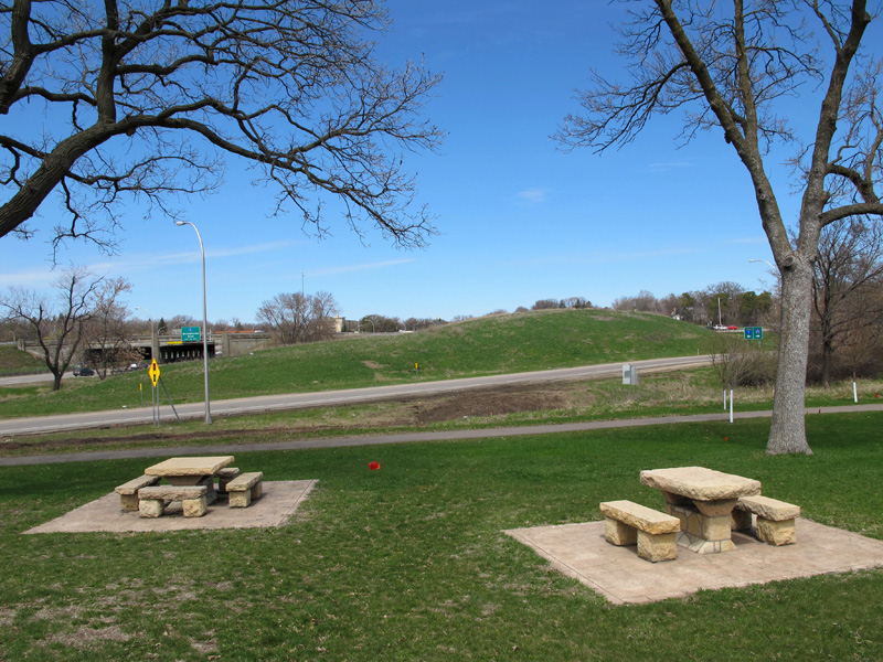 Two of the restored picnic benches, with the old Highway 7 interchange as a back-drop (the original bridge has since been replaced and the interchange rebuilt).
 Restored picnic bench and the old Highway 7 overpass.
 One of the other major features of the park is the restored council ring (view looking south). The walking trail in the background follows what was once a circular driveway that encircled the picnic area, now closed to automobile traffic.
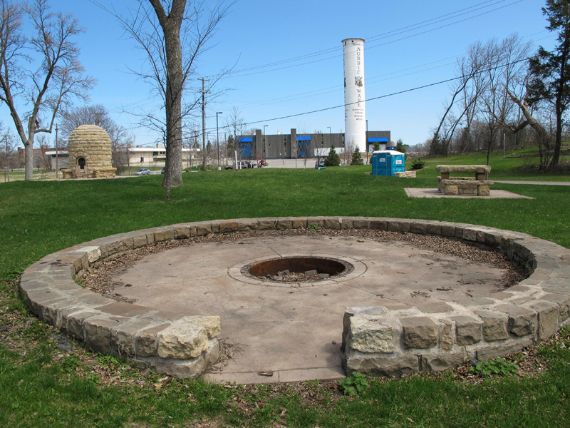 In this second image of the ring (looking east) you can see both the beehive, and the historic Peavey–Haglin Experimental Concrete Grain Elevator, now painted with the logo of “Nordic-Ware” (see the wikipedia article on this important historic structure here).
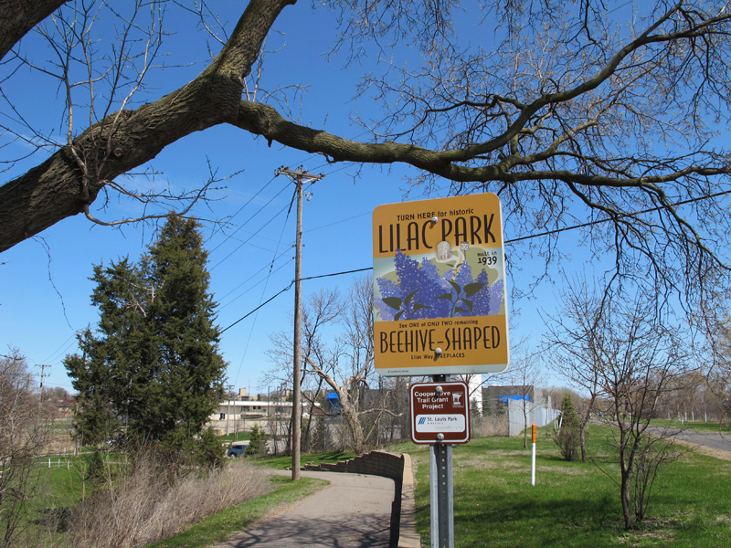 The park is directly accessible from the Cedar Lake Regional trail. This sign attempts to attract visitors from the trail with promises of beehive-shaped fireplaces.
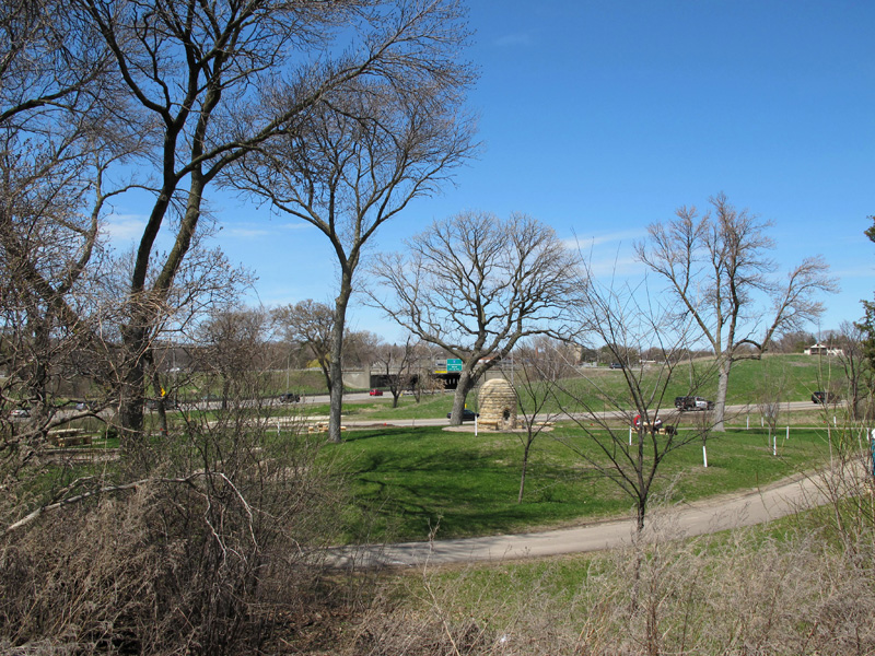 A last overview of the park, looking northwest from the Cedar Lake trail.
>> Back to Historic Highway Tours
Links and Sources
Restore Lilac Way - Website created to document the history of the seven original 1939 parks and support restoration and preservation of Graeser Park and Rock Island. Raises awareness for restoration and preservation of Lilac Way through events, social media and promotions. Follow the group on Facebook. (Thank you to Karen Laukkonen for the corrected info and links!)
Highway 100 "Lilac Drive" Documentary (from the TPT Video Archive)�- This must-watch documentary was made in 2001 and gives a full overview of the construction of Lilac Way / The Beltline and its historical significance.
St Louis Park Historical Society - The SLPHS has several pages dedicated to Lilac Way and its roadside parks.
- Highway 100
- Highway 100's Roadside Parks - Scroll down for individual park page listing.
MnDOT Historic Roadside Inventory Report: St Louis Park Roadside Park
MnDOT Construction Project Log Record: Control Section 2735.
Kerr, Drew. "On Highway 100, relief finally in sight". Finance & Commerce. August 12, 2012. url: http://finance-commerce.com/2012/08/on-highway-100-relief-finally-in-sight/