Historic Minnesota Highways Interactive Map - User's Guide
This interactive map allows you to see the "where", and "when" of the various routes of Minnesota's Trunk Highway System, from 1921 to the present day. This guide details the various functions and information available.
Note: At present (June, 2015), the road data is only complete for Hennepin County, but will expand outward as time allows.
What's a trunk highway you ask? Check out the Minnesota Highway History Primer!
Using the Map
When the map loads, it initially shows all past and present trunk highways, color coded by when they were retired (current routes are also shown). By using the menu at the top, you can limit to map to display only the roads used by a selected route, in a selected year, or both! You can use the "Reset ALL" button to set the display back to its initial state at any time.

Initial map screen.
Limiting by Route
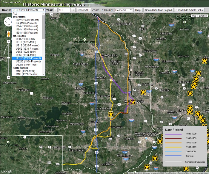
Pick a route from the drop-down list. Only roads that were used at some point by the selected route will be shown.

All roads used by US 169 in Hennepin County.
Limiting by Year
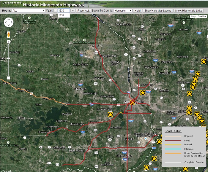
You can pick a year by typing it in the "Year" field and pressing "Enter" on your keyboard, or use the "+" and "-" buttons to step forward or back through time (these buttons will reset the year to "ALL" when you reach the limits of the available time span). The line colors change to represent the status of roads on about July 1 (i.e., at the beginning of the construction season), creating an approximation of what you would have seen on a road map for that year.

Highways in 1930.
Limiting by Route AND Year
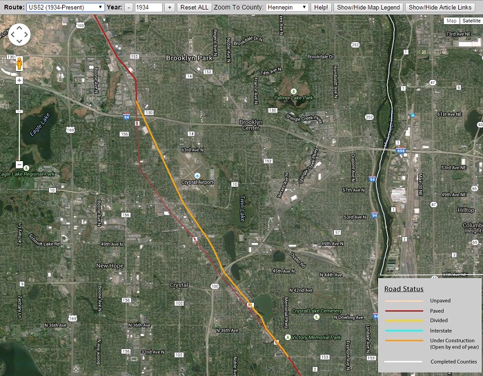
The display can be refined to show only the roads in use by a single route in a given year. Roads that ceased to be used by the selected route in that year will appear partially transparent, and roads under construction to be completed later that year will also be shown (this feature is only available when limiting by both route and year).

Image showing US 52 in 1934, with a new corridor nearing completion and the old temporary road about to be bypassed.
Getting Detailed Information on a Corridor
To get more information on any line segment, hover your cursor over a road, and it will be highlighted to show its extent. Click on the feature to get details on when it was in use as a trunk highway, which routes used that road, a short history, and any comments.

Info box for the Old Washington Avenue Bridge near the University of Minnesota.
Access Detailed Articles
The yellow star markers scattered across the map represent links to articles on various historic roads, bridges, and roadsides. Click on them to access a link (articles open in a new tab). These markers can be turned off in case they get distracting.

Marker and article link.
Understanding the Map Data: "Corridors"
The lines on the map represent what I call "corridors" - a summarization of the location of a highway over a span of time. The road's alignment may have varied within that corridor to some degree over the years, but I have chosen to show only the final location of the highway's approximate centerline. For an extreme example of this concept, see the image below, where I have a short line segment that represents both I-394 (a huge multi-lane freeway), as well as its earliest predecessor - a primitive 14 foot wide concrete road built before 1920.

Image showing an example of a corridor that has evolved from a 14-foot wide concrete road into a multi-lane freeway.
Primary sources used for the creation of the road data included:
- MnDOT Construction Project Logs
- MnDOT Construction plans
- Official Highway Maps
- Other road maps in my collection from various publishers
- Historic aerial photos
- Newspapers (Star Tribune)
- "Minnesota Highways" - the official employee newsletter of the Minnesota Department of Highways
- Captures of MnDOT's web site via the "Way-Back Machine".
- "Minnesota Highway News" - press releases from the Highway Department, accessed via microfiche at the Minnesota Historical Society.
Some of these sources are directly cited in the road histories accessed from the map.
Despite the large amount of documents available, there are still some gaps and major uncertainties in the data, especially in the very early days of the highway system (the 1920's). These are spelled out where possible in the comments accessed by clicking on the road features.
I have striven for accuracy, but some errors have undoubtedly crept into the data. If you see anything that looks wrong, or you have a good primary source that refutes the map, please share it with me! I want this map to be as historically accurate as possible, and I need your help to do it!
Technology Used
The map is powered by the Google Maps JavaScript API, with further functionality provided by jQuery.
The highway corridor and county line data are encoded as geojson files using QGIS.
The articles links are encoded using KML (compressed to KMZ) and created using Google Earth.