
Home >> Projects >> U.S. 61 >> Modern Highway Photo Galleries
 Modern Highway Photos: I-494 to Red Wing
March, 2007 (Page 5)
>> Jump to Page: 1 | 2 | 3 | 4 | 5 | 6

Looking east at the Goodhue County Line. The west end of the divided highway
to Red Wing is visible just ahead

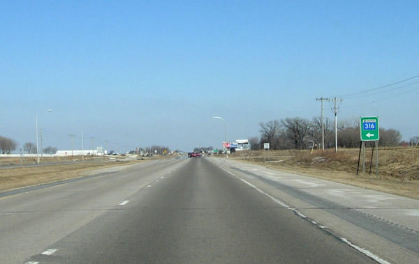
Eastbound on the divided section of U.S. 61 in western Goodhue County, approaching
the south junction with Highway 316. This stretch of highway is the newest
divided section of U.S. 61 in Minnesota. It was constructed between 1996 and
1997. The old two-lane road ran along the alignment of what is now the southbound
lane.

Getting closer to the junction with Hwy. 316. The land just north and west
of the Cannon River valley in far northwestern Goodhue County is on an incredibly
flat outwash plain.
At the rather nondescript south junction with Highway 316. The south junction
has been at this site since Highway 316 was first marked in 1959.

Eastbound, approaching Welch Village Road. The historic church on the right
has been a landmark on the road to Red Wing for more than a century.

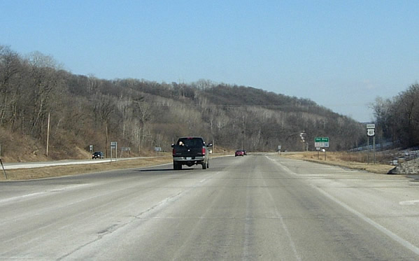
Looking east towards the beginning of the descent into the Cannon River Valley.
The road on the left is County Road 31.

The new divided road up the hill on the north side of the Cannon River Valley
required the cutting of channels through the bedrock, just visible on the
right.

A closer view of the rock-cuts made in 1996/97.

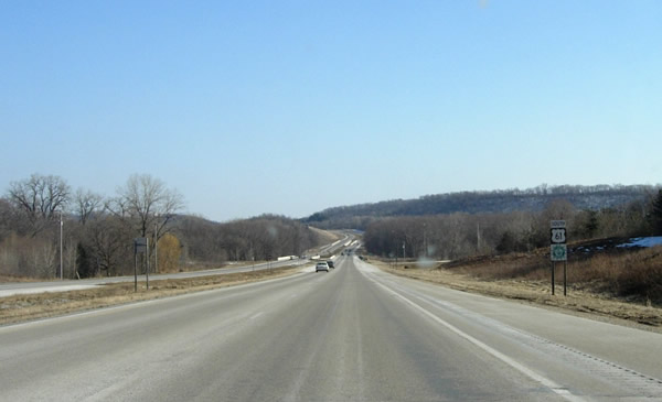
Approaching the last curve before the junction with County Road 18, one of
the routes to the Treasure Island Casino on the Prairie Island Indian Reservation.
Entering the Red Wing city limits at the junction with County Road 18.
A view to the southeast from the junction with County Road 46, showing the
divided highway through the Cannon River Valley. The divided highway between
County Road 18 and State Highway 19 (on top of the hill ahead) was completed
between 1993 and 1994, although part of the new northbound lane was actually
completed in 1985.

A view of the rather boring modern bridges over the main channel of the Cannon
River, both completed in the 1993/94 project. These bridges replaced the old
steel-truss span constructed in 1931.

The two bridges over the south channel of the Cannon River. The northbound
bridge (on the left) was constructed in 1984. The southbound bridge was constructed
in 1993.

A view to the southeast towards the junction with State Highway 19 from Cannon
Bottom Road (also Hwy. 19's eastern terminus, the route markers are visible
on the far right). Highway 19 was first marked here in 1934. Note the subdivision
on top of the hill in the distance.
>> Next Page
>> Page Index
- Page 1 - New Freeway and Interchange with I-494 at Newport
- Page 2 - Cottage Grove and the Jct. with State Hwy. 95
- Page 3 - Jct. with U.S. 10 to the North Jct. with Hwy. 316 at Hastings
- Page 4 - Southern Dakota County
- Page 5 - Eastern Goodhue County and the Cannon River Valley
- Page 6 - Red Wing
>> Back to the Photo Gallery Index
>> back to top