
 Historic U.S. 61: Old Road at "4 Corners"
Old Road at "4 Corners"
Located In: Douglas Township, Dakota County.
Bypassed: 1930
Length: 0.86 miles
Also Marked As:
 1921-1930
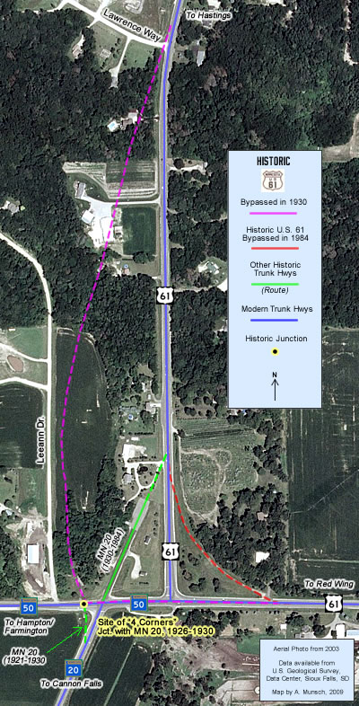
U.S. 61's original alignment in the vicinity of the junction with Highways 50 and 20 in southern Dakota County was through an intersection shown as "4 Corners" on highway plans. The old road ran parallel and just to the west of modern U.S. 61, until it made a hart right-turn at "4 Corners", from where it followed the east end of modern Highway 50 and U.S. 61 towards Red Wing.
Construction
The old road was still gravel when U.S. 61 was first marked along it in 1926. It was paved with an oil treatment in 1927.
Bypass History
The original road was bypassed in 1930 by the construction of the first paved highway between Hastings and Red Wing. U.S. 61 was realigned to the east of the original road to eliminate the old four-way intersection and right-angle turn using a gradual curve that allowed traffic on the highway between Hastings and Red Wing to flow continuously.The east/west portion of the old road was rebuilt and paved with 20 feet of concrete in 1931 to act as a connection between Highway 20 and the new alignment. The north/south portion of the old road was left behind as a local drive.
Current Status
The north/south section was eventually abandoned and destroyed by cultivation or development. The east/west portion became the east end of State Highway 50 in 1949. It was rebuilt in 1984 as part of the reconstruction of the junction (U.S. 61 ended up being restored to a very short stretch of its original alignment).
Historic Junction:  1926-1930
The original junction with State Highway 20 was at the intersection shown as "4 Corners" on old highway plans. The four-way intersection was located along what is now State Highway 50, just to the west of the junction with State Highway 20. The intersection was the meeting place of roads leading to Hastings (north), Cannon Falls (south), Farmington (by way of Hampton - west), and Red Wing (east). In the 1920's there was a dance hall on the northwest corner, a service station on the northeast corner, and the Douglas Town Hall on the southeast corner.
Photo Tour - Photos from various dates.
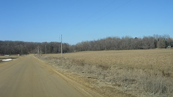
Looking north up LeeAnn Avenue, northwest of the current junction of Highways 50 and 20. The original road used by U.S. 61 ran through
the field on the right up into the line of trees on the horizon. All signs
of the original road appear to be gone. Photo from
March, 2007.
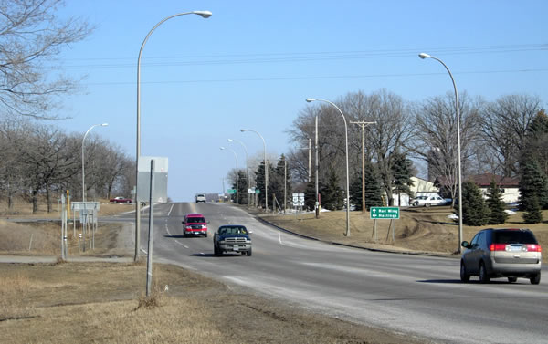
Looking east down Highway 50 towards the modern junction with U.S. 61. Just ahead is the site of "4 Corners. The old gravel road followed what are now Highway 50 and U.S. 61 into the horizon.
Photo from March, 2007.
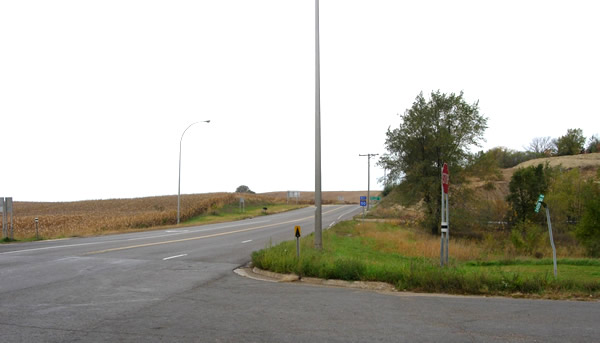
Another view, looking west from the junction of Highways 50 and 20 towards the site of "4 Corners".
Photo from October, 2005.